 Guide to the Azores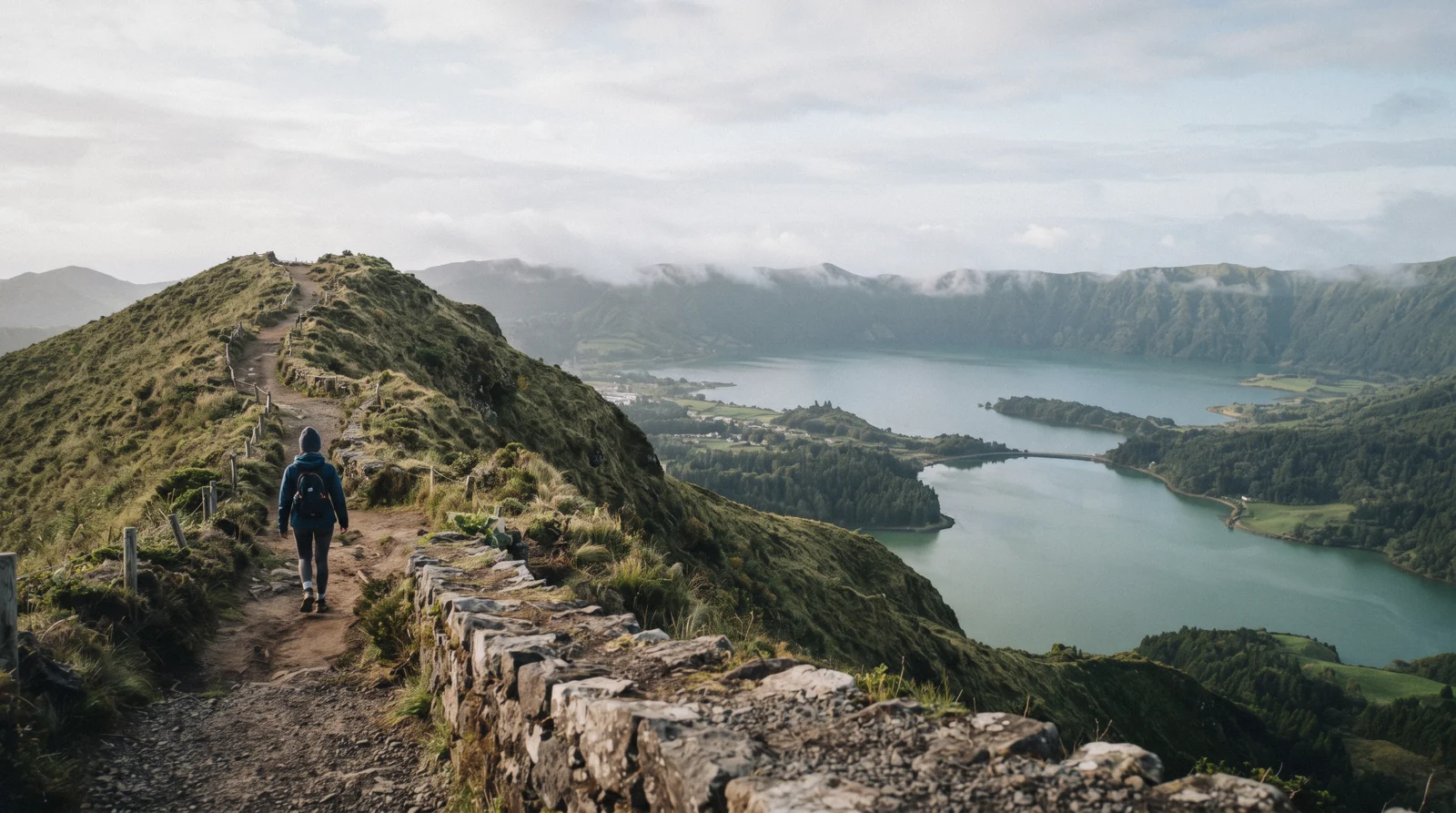
Hiking In The Azores: Trails, Stats And Access Rules
Hiking in the Azores runs from an easy crater rim stroll to the roof of Portugal, and every figure on this page comes from an official trail or island page. São Miguel carries the biggest signed network of azores hiking trails, Pico holds the highest summit at 2,350 m, and São Jorge drops off its own ridge onto the fajãs. Start with the trail tables below, then book a half-day hiking tour or plan around the two access rules that change itineraries. Every figure sits inside the Guide to the Azores.
Quick answer The signature trails, the access rules, what guided options cost
Hiking in the Azores is free at the trailhead: no park on the network charges for the Sete Cidades rim walks or the Nordeste viewpoints. The headline records are São Jorge's PR01SJO, 9.3 km in 2h30 down to the fajãs, and Pico, Portugal's highest point at 2,350 m, booked only through the government portal with a price it does not publish. Two rules change plans: the Lagoa do Fogo road closes to private vehicles during the shuttle season, and Pico da Vara needs a permit form.
Key takeaways
- The cheapest guided intro is the Sete Cidades half-day hiking tour at $51.66, with an honest 3.1 rating from 5 reviews.
- The Pico booking rules sit in a government portal that offers an unguided category, so the mandatory-guide claim is unproven.
- The Lagoa do Fogo access rule and its $9.17 (€8) shuttle apply from 1 August to 30 September in the season on record.
The Signature Hike On Each Island
Each island has one walk that defines it, and this table lines them up with the figures printed on the official pages, plus the practical catch that catches people out on each one.
| Island | The signature walk | Official stats | The catch |
|---|---|---|---|
| São Miguel | PR03SMI Vista do Rei to Sete Cidades | 6 km, 2h, easy, linear | Trailheads free, but the Fogo road closes to private cars in shuttle season |
| Pico | The mountain climb, from about 1,250 m to the 2,350 m summit | Highest point of Portugal, Piquinho cone in the crater | Booked only through the official portal, price not published |
| São Jorge | PR01SJO Serra do Topo to Santo Cristo to Fajã dos Cubres | 9.3 km, 2h30, medium, linear | Ferry ports Velas and Calheta sit on the triangle only |
| Flores | The waterfall coast between Fajãzinha and Fajã Grande | Almost twenty waterfalls, Ribeira Grande 300 m high | Reached by flight, there is no road from the central group |
| Faial | The Capelinhos 1957-58 coast and the Caldeira | A fragmented lake 450 m below the Caldeira lookout | Interpretation centre price not officially verified |
| Graciosa | Furna do Enxofre inside the Caldeira | 183 spiral steps down to a dome about 40 m high | Visitor centre hours verified only from a dated official snippet |
Distance and time figures come from the official trail and island pages. Conversions use €1 = $1.146. Figures in Q3 2026.
Sete Cidades, The Crater Rim Walks
The Sete Cidades massif on São Miguel holds three official trails you can walk without any booking, and all of them start at free viewpoints or car parks.
PR03SMI, The Vista Do Rei Descend
This is the walk most people picture when they picture azores walks. It starts at the Miradouro da Vista do Rei, named for King D. Carlos and Queen D. Amélia, who visited the spot on 6 July 1901, and it runs 6 km, easy and linear, from the miradouro down into Sete Cidades village. The parks page lists it as active with the standard stats, and the trailhead viewpoint is free, like every viewpoint in the network.
The practical plan is to arrive early, walk down into the village, and leave the return leg to whatever transport you arranged, because the trail is one-way by design. The village, the lake and the free visitor centre are covered in Sete Cidades.
Two More Official Trails In The Same Massif
PR04SMI runs from Mata do Canário to Sete Cidades, linear and easy, 11 km at about 3 hours, the longer way along the crater rim. PRC05SMI Serra Devassa is a circular loop of 4.2 km, about 2 hours, starting and finishing near the Mata do Canário parking area by Lagoa do Canário, which makes it the option for a short day. For a guided version of the area, the Sete Cidades half-day hiking tour is the low-commitment route, and the visitor centre below the miradouros is free, though it closes on weekends in the winter season from 1 November.
| Trail | Route | Length | Time | Difficulty | Shape |
|---|---|---|---|---|---|
| PR03SMI | Vista do Rei – Sete Cidades | 6 km | 2h | Easy | Linear |
| PR04SMI | Mata do Canário – Sete Cidades | 11 km | 3h | Easy | Linear |
| PRC05SMI | Serra Devassa | 4.2 km | 2h | Easy | Circular |
All stats from the official trail pages on the regional parks network, checked against the source records.
Lagoa Do Fogo And The Road That Closes
Lagoa do Fogo sits in a caldera at the island's centre, and its access road is the one rule on São Miguel that genuinely rewrites itineraries.
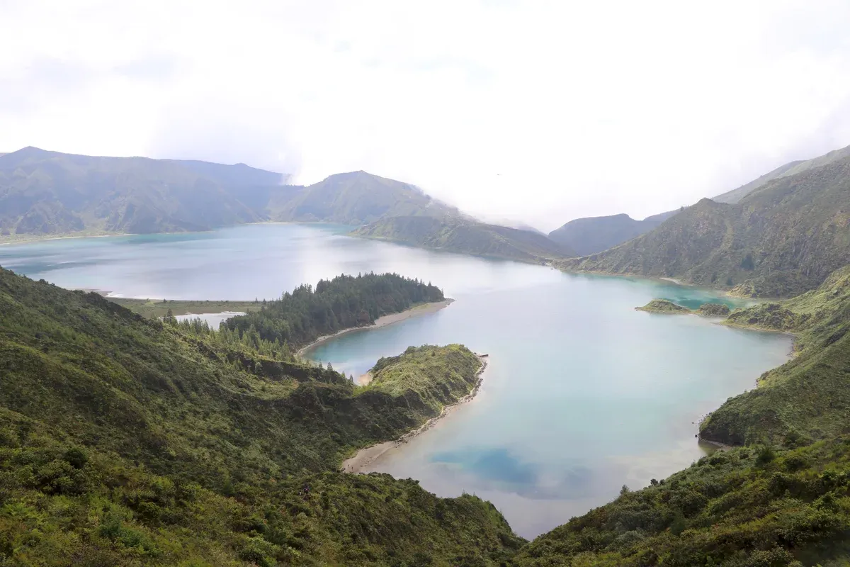
The Lagoa do Fogo caldera from the rim road, free at the viewpoint with the seasonal closure described above. Photo: Navin75, CC BY-SA 2.0, via Wikimedia Commons
The Trail And The Shuttle Rule
PRC02SMI Praia to Lagoa do Fogo is the official trail to the water, circular, medium, 12 km at about 4 hours. During the shuttle season, which runs 1 August to 30 September 2026, 09:00 to 20:00 daily, the road between Caldeira Velha and Casa da Água is closed to private vehicles, and only tour operators, travel agencies, taxis and residents may drive it. The official Shuttle Vulcão do Fogo runs two hop-on hop-off lines of about 60 minutes each, with hop-off pauses of 3 to 10 minutes per stop, and tickets are bought on the bus.
Outside the season the restriction does not apply, and the winter rules are a re-check item on the official page. The full access picture is in Lagoa do Fogo.
| Access fact | Detail |
|---|---|
| Shuttle season | 1 August to 30 September 2026, 09:00-20:00 daily |
| Red line | Caldeira Velha to Bela Vista to Pico da Barrosa to the miradouro, about 60 min |
| Green line | Casa da Água to Pico da Barrosa to the miradouro, about 60 min |
| Adult ticket | $9.17 (€8), non-resident, bought on the bus |
| Reduced ticket | $4.58 (€4), non-resident children 7-12 and seniors 65+ |
| Free categories | Under 6 and all Azores residents |
| Parking | About 200 spaces total: Caldeira Velha 101, Casa da Água 60, 48 at the miradouro reserved for operators, taxis and residents |
The Salto Do Cabrito Correction
PRC29SMI Caldeiras da Ribeira Grande to Salto do Cabrito is often lumped into Fogo trip plans because the official shuttle page names it as reachable from the Caldeira Velha stop, a 2 km walk away. The correction matters for searchers: it is a Ribeira Grande trail, not a Lagoa do Fogo trail. The same shuttle page lists PR41SMI and PRC37SMI, the two Rota da Água routes, as the walks from the Casa da Água stop.
After either, Caldeira Velha is the paid soak next door, entry by prior reservation during the shuttle season.
Prices, lines and parking caps are from the regional government shuttle page.
Pico Mountain, The Climb That Owns A Booking Portal
Pico is the highest point of Portugal, and it is the only Azores walk with its own government booking site.
The Mountain
The summit stands at 2,350 m, which the official visitor material calls the highest point of Portugal, and the climb begins at roughly 1,250 m. Inside the crater rises the lava cone known as Piquinho, with fumaroles at its top. Everything is booked through montanhapico.azores.gov.pt, run by SRAAC for the regional government, and the reservation is what guarantees your place on the mountain.
One domain warning worth repeating: picomountain.com is a ski resort in Vermont, and it is not the Azores booking portal. The island around the mountain, vineyards and whales included, is on Pico Island.
Guide, Price And The Night Window
Here is the correction most summaries get wrong. The booking form offers an autonomous ascent without guide, the Subida autónoma sem guia category, so the claim that a guide is mandatory is unproven on the portal's own text, and a paid accredited guide is positioned as recommended rather than obligatory. The climb price is not published anywhere you can read outside the booking application, and third-party figures such as €15 are not official, so this page prints none.
Night climbs start between 16:00 and 24:00 and require presentation at Casa da Montanha in Madalena, whose own opening hours are also not stated on the fetchable pages. The booking mechanics are on Pico Mountain and Pico mountain tickets.
| Climb fact | On record |
|---|---|
| Summit height | 2,350 m, the highest point of Portugal |
| Climb start | About 1,250 m |
| Crater cone | Piquinho, with fumaroles |
| Booking portal | montanhapico.azores.gov.pt, run by SRAAC |
| Unguided option | Subida autónoma sem guia exists, guide-mandatory claim unproven |
| Climb price | Not published, visible only inside the booking app |
| Night window | Starts between 16:00 and 24:00, presentation at Casa da Montanha, Madalena |
Every unpublished line above was chased to the portal itself, which keeps them inside its booking application.
São Jorge, Down To The Fajãs
São Jorge is a long ridge of an island, 56 km from end to end, and its trails drop off the edges onto coastal platforms called fajãs.
PR01SJO, The Classic Descent
The signature walk runs Serra do Topo to Caldeira de Santo Cristo to Fajã dos Cubres, 9.3 km on the official stats, about 10 km in the page's own narrative, average time 2h30, medium difficulty, linear, and listed as active with no closure alert. The lagoon of Caldeira de Santo Cristo at the midpoint is a protected landscape known for its clams, a habitat for resident and migrant birds, and a surf and bodyboard sanctuary, which makes the descent as much a food and coast trip as a walk. The official trail page carries GPX, KMZ and PDF downloads, so navigation needs no third-party app.
The island plan is in São Jorge.
Getting There And The Other Listed Trails
São Jorge is 56 km long and 6 to 8 km wide, with ferry ports at Velas and Calheta, and both sit on the Faial-Pico-São Jorge triangle, so the island is a triangle-leg trip rather than a day swap from São Miguel. The official trail list also carries PRC10SJO Caminho das Fontes, PRC08SJO Fajãs do Toledo, PR04SJO Pico do Pedro to Pico da Esperança to Fajã do Ouvidor, and the long-distance routes GR01SJO East and GR02SJO West, all published on the same trail portal with their own downloads.
| Trail | Route on record |
|---|---|
| PR01SJO | Serra do Topo – Caldeira de Santo Cristo – Fajã dos Cubres, 9.3 km, 2h30, medium, linear |
| PRC10SJO | Caminho das Fontes |
| PRC08SJO | Fajãs do Toledo |
| PR04SJO | Pico do Pedro – Pico da Esperança – Fajã do Ouvidor |
| GR01SJO / GR02SJO | East and West long-distance routes |
Trail codes and routes from the official São Jorge list on trails.visitazores.com.
Flores, The Waterfall Coast
Flores is the wet, western edge of the archipelago, and its hiking reward is a coastline that falls into the sea.
Almost Twenty Waterfalls
The official island page counts almost twenty waterfalls on the coast between Fajãzinha and Fajã Grande, with Ribeira Grande the standout at 300 metres high, and two named swimming pools below them, Poço do Bacalhau and Poço da Alagoinha, also known as Lagoa dos Patos. One correction belongs here because the name circulates so widely: Poço da Ribeira do Ferreiro is not mentioned by name on the official island page, so treat lists built around it as unofficial. Getting to Flores is part of the plan, because no road or ferry links it to the central group, and the trip means a SATA or Azores Airlines flight, with the island detail in Flores Island.
| Fact | Figure on record |
|---|---|
| Waterfalls on the Fajãzinha to Fajã Grande coast | Almost twenty |
| Ribeira Grande fall | 300 metres high |
| Named pools | Poço do Bacalhau, Poço da Alagoinha (Lagoa dos Patos) |
| Poço da Ribeira do Ferreiro | Not named on the official island page |
| Access | Flight only, no ferry from the central group |
All lines from the official Visit Azores Flores page.
Faial And Graciosa, Volcanoes You Walk Into
Two central islands let you walk straight into volcanic geology, one above ground on Faial and one below it on Graciosa.
Faial: Capelinhos And The Caldeira
The Capelinhos volcano erupted between 1957 and 1958, tossing out grey ash and lapilli, and it stands as the last volcanic eruption in the Azores. The old lighthouse tower, half buried by that eruption, now holds the interpretation centre. On the other side of the island, the Caldeira holds a fragmented lake and a small volcanic cone 450 m below the lookout.
One price warning: the centre's ticket figure is not officially verified, with conflicting third-party numbers, so this page prints none. A full-day Faial guided tour covers both sites with a local guide, and the island context is in Faial and Capelinhos.
Graciosa: Furna Do Enxofre
The Caldeira da Graciosa is an elliptical collapse structure, 1.6 to 0.8 km across and 270 m deep with a rim at 405 m, the smallest central volcanic structure of the Azores. Inside it sits Furna do Enxofre, a cave with a dome about 40 m high at the centre, a cold-water lake, a mud fumarole responsible for the sulphur smell, and access down a spiral staircase of 183 steps built in the early twentieth century. The visitor centre hours on record come from a dated snippet of the official page, so confirm before crossing, and the island page is Graciosa.
| Site | Figure | On record |
|---|---|---|
| Capelinhos eruption | 1957-1958 | Last volcanic eruption in the Azores |
| Capelinhos centre | In the old lighthouse tower | Ticket price not officially verified |
| Faial Caldeira | 450 m | Lake and cone below the lookout |
| Graciosa Caldeira | 1.6 to 0.8 km wide, 270 m deep, rim 405 m | Smallest central volcanic structure of the Azores |
| Furna do Enxofre | Dome about 40 m high, 183 steps | Cold lake and mud fumarole inside |
Figures from the official Visit Azores island pages.
Access Rules That Change Plans
Most of the trail network costs nothing and asks nothing of you. Two rules are the exceptions, and one of them is seasonal.
The Pico Da Vara Permit
Pico da Vara on São Miguel is the one trail in this whole network where access is conditional. The trail runs 12 km, difficult, about 6 hours, and the official page states plainly that access is restricted: O acesso ao trilho está condicionado, granted through the form on trails.visitazores.com. Apply before you go rather than at the trailhead, and expect the link and process to be re-checked each season, because the permit sits on the portal rather than on printed signage.
Everything Else Is Free
Trailheads and viewpoints on the parks network are free, with no fees at Sete Cidades or at the Nordeste miradouros, Santa Iria, Ponta do Sossego and Tronqueira included. The only paid access window to plan around is the Fogo shuttle season on the road between Caldeira Velha and Casa da Água. If you are skipping the rental car entirely, the azores without a car plan shows how the shuttle and the guided days replace it, and the east coast viewpoints are in Nordeste.
| Rule | Detail |
|---|---|
| Pico da Vara access | Only with the official form at trails.visitazores.com |
| Pico da Vara stats | 12 km, difficult, about 6h |
| Parks network fees | None for Sete Cidades or the Nordeste viewpoints |
| Fogo road | Closed to private vehicles 1 August to 30 September 2026 |
| Everyone else | Open trailheads, free viewpoints, no booking |
The free-entry finding comes from the parks network itself, which publishes no trail fees for these areas.
Weather, Safety And What The Record Says
The climate numbers come from the national weather service for Ponta Delgada, and they explain why rain gear stays in the pack all year.
Rain Days And Temperatures
Ponta Delgada averages 122.3 rain days a year, with 15.0 rain days in the wettest month of December and 4.8 in July. Mean daily highs run from 17.5°C in January to 26.0°C in August, so no month is a heat risk and every month is a shower risk. That spread is the practical case for packing a shell in every season, and the month-by-month view is on best time to visit.
Safety And Cover
112 is the emergency number and works from any phone in Portugal. The EHIC covers medically necessary state healthcare but not repatriation or planned treatment, so hiking insurance still earns its line in the budget. One record gap matters on Pico: the weather-call closure policy is not published on the official portal, so conditions are confirmed through Casa da Montanha rather than a printed rule.
| Fact | Figure | On record |
|---|---|---|
| Rain days per year | 122.3 | Ponta Delgada average |
| Rainiest month | December, 15.0 rain days | IPMA normals |
| Driest month | July, 4.8 rain days | IPMA normals |
| Mean daily highs | 17.5°C January to 26.0°C August | Ponta Delgada station |
| Emergency number | 112 | Works from any phone in Portugal |
| EHIC cover | Medically necessary state care | No repatriation, no planned treatment |
| Pico weather policy | Not published on the official portal |
Climate lines are IPMA 1991-2020 normals for the Ponta Delgada observatory station.
Guided Options And What They Cost
Four bookable options cover the range from a first crater walk to a canyon descent, and their ratings are printed as they stand.
Reading The Ratings Honestly
The Sete Cidades half-day hiking tour is the cheapest way onto the crater rim with a guide at $51.66, but its rating is 3.1 from only 5 reviews, so read those reviews before booking rather than after. The Salto do Cabrito canyoning at $86.09 carries the strongest record on this page, 5.0 from 120 reviews. The medium-level canyoning is the harder version of the same gorge at $103.31, and the Faial full-day tour pairs the Capelinhos coast and the Caldeira with a local guide at $113.64.
All four prices come from the operator listings as they stand.
| Tour | Price | Rating | Reviews |
|---|---|---|---|
| Sete Cidades Half-Day Hiking Tour | $51.66 | 3.1 | 5 reviews |
| Salto do Cabrito Canyoning Adventure | $86.09 | 5.0 | 120 reviews |
| Medium-Level Canyoning, Salto do Cabrito | $103.31 | 5.0 | 6 reviews |
| Full-Day Faial: Capelinhos, Caldeira and Local Guide | $113.64 | 5.0 | 69 reviews |
Prices and ratings are operator listing figures, not ours to adjust.
Hikes And Canyons You Can Book
Four tours covering the Sete Cidades crater, two canyoning grades and a full day on Faial.
 from $51.66
Small group
from $51.66
Small group Sete Cidades: Half-Day Hiking Tour
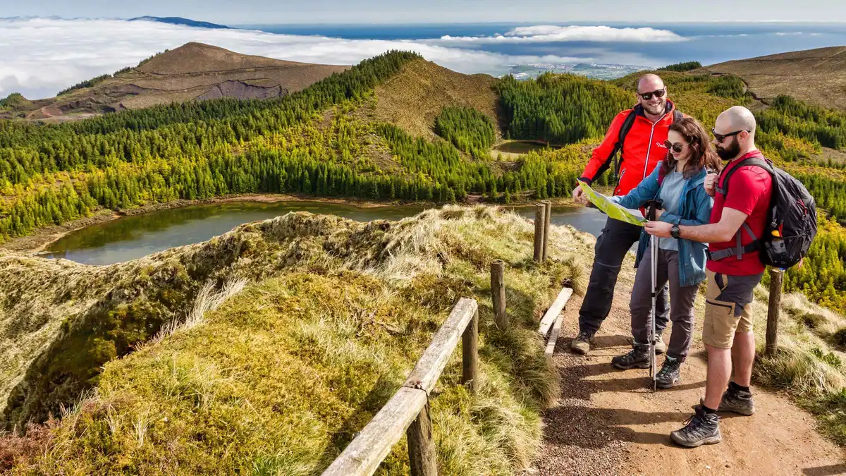
A 6.3 km guided walk across the Sete Cidades basin, taking in Lagoa do Canario, Pico das Eguas and viewpoints over several lakes, with geology and history along the way. Groups are capped at eight and the meeting point is the Futurismo office at Portas do Mar. Good for travelers who want a proper half-day hike with context, as long as no one in the party is under eight.
Check Availability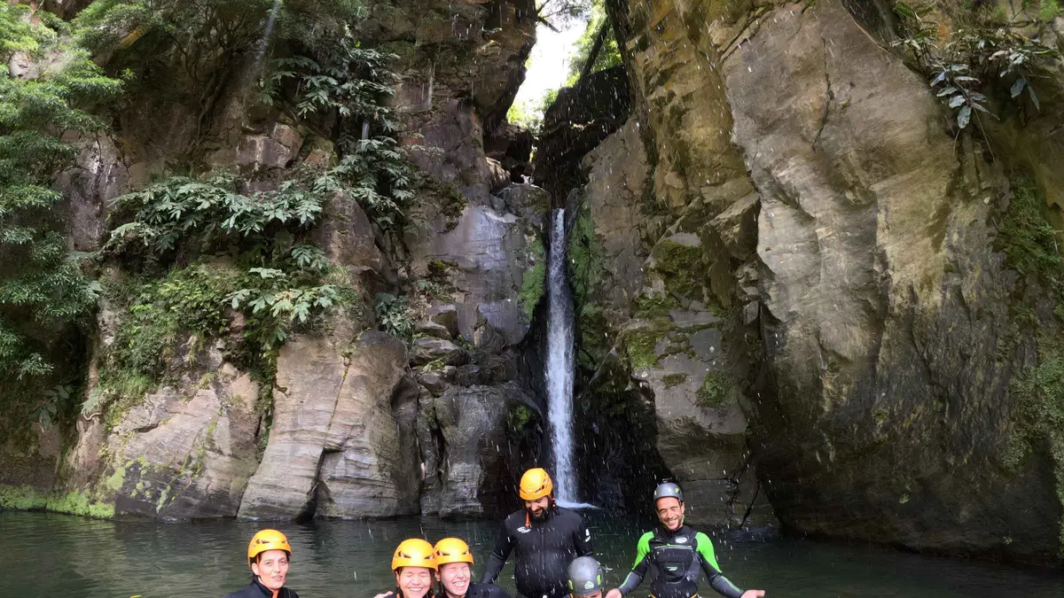 from $86.09
Small group
from $86.09
Small group Azores: Salto do Cabrito Canyoning Adventure
A four-hour canyoning day at Salto do Cabrito with a 30-minute approach hike, then rappels, optional jumps and swims through a chain of waterfalls, with equipment, guides and photos included. The operator asks for good health and a moderate fitness level, sets a minimum age of 10, and caps weight at 120 kg. Good for beginners and mixed groups who want a complete canyon without the technical label.
Check Availability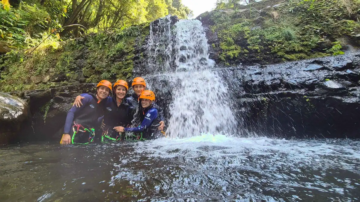 from $103.31
Small group
from $103.31
Small group Canyoning Adventure: Medium-Level Canyoning Salto do Cabrito
A medium-level canyoning route at Salto do Cabrito with jumps of 6 to 8 meters (always optional), natural rock slides and rappels past 20 meters, run by ICA-certified guides in groups capped at eight. A photo package is included. Good for travelers with some outdoor experience who want the harder line.
Check Availability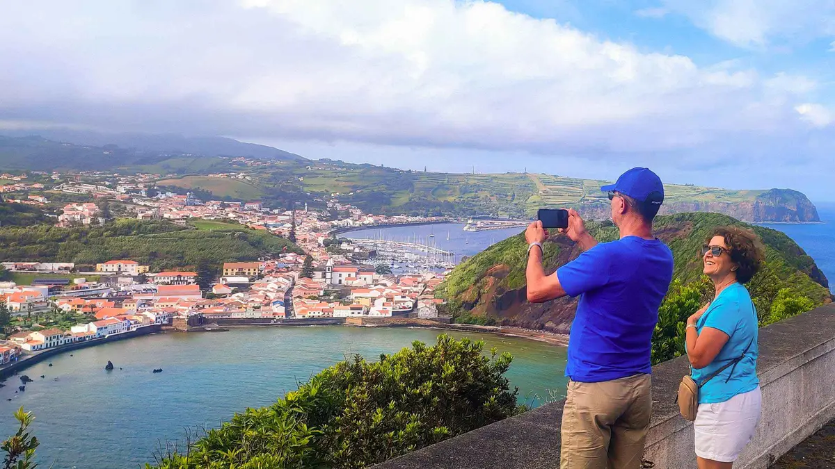 from $113.64
Full-Day Faial: Capelinhos, Caldeira & Local Guide
A full-day lap of Faial with local guide Ramiro, taking in the Caldeira, the Capelinhos volcano and quiet viewpoints at a relaxed pace, with hotel pickup, mineral water and a lunch option. The operator advises a waterproof jacket because the weather can change fast. Good for travelers who want one island explained by someone who lives on it.
Check AvailabilityPrices, ratings and details are the platform's own. dollar figures are the listed prices — the platform bills in your account's currency.
Where The Trail Planning Continues
Pico Mountain
The climb itself, and how the booking portal actually works.
Lagoa Do Fogo
The shuttle season and the closed road, explained day by day.
São Jorge
The fajãs, the ferry ports and the PR01SJO descent.
Azores Without A Car
Reaching trailheads by bus, shuttle and guided day.
Hiking In The Azores: Questions
Which Azores island is best for hiking?
São Miguel has the biggest signed network, with the crater rim walks at Sete Cidades and the medium 12 km loop to Lagoa do Fogo. For specific records, São Jorge holds the classic fajã descent on PR01SJO and Pico holds the country's highest summit. The signature table above lines them up with official stats.
What is the best month to go to the Azores?
On the rain record, July is the driest month with 4.8 rain days against December's 15.0, and mean highs never leave the 17.5°C to 26.0°C band. The month-by-month breakdown is in best time to visit.
Do you need a guide for Pico?
Not proven either way. The official booking portal offers an autonomous ascent without guide, so the mandatory-guide claim is unproven, while a paid accredited guide is recommended. The price sits inside the booking app and is not published. The mechanics are on Pico mountain tickets.
Are the hiking trails in the Azores free?
Yes, at the trailhead. Parks network trailheads and viewpoints carry no fees, from Sete Cidades to the Nordeste miradouros. The exceptions are access rules, not fees: the Pico da Vara permit form and the Fogo shuttle-season road closure.
What do Azoreans eat for breakfast?
That question belongs to the table rather than the trail, so this page leaves it to the Azores food guide.
Which is better for hiking, Madeira or Azores?
No sourced comparison exists in the official material behind this page, so no fair verdict can be printed here. What this page does prove is the Azores side of the ledger, and the trade-offs are discussed in Azores vs Madeira.
Azores Trails On Video
Three walking films that show the range of terrain this page prices and rules.
Hiking Alone In The Azores
A solo walking film across the islands, useful for a feel of the terrain before you pick trails.
Video: Kraig AdamsHiking 80 Miles Across The Azores
A long-distance crossing that shows what the multi-day ambition on these islands looks like.
Video: Liam BrownThe Sete Cidades Hike
A walkthrough of the crater rim trail at Sete Cidades, the PR03SMI country described above.
Video: The Traveling ZAMVideos load from YouTube only when you press play.
We may earn a commission if you book through one of our links, at no extra cost to you. Full affiliate disclosure