 Guide to the Azores
São Jorge Azores: The Ridge Island Of Fajãs
São Jorge, Azores, is a 56 km long and 6 to 8 km wide ridge, 246 km² of it, standing between Faial and the rest of the central triangle, and everything a visitor does on it runs either along the ridge or down to the fajãs, the coastal platforms at the foot of its cliffs. This guide uses the official trail codes and figures (PR01SJO is 9.3 km, average time 2h30, difficulty Medium) instead of blog roundings, explains what a detrital fajã actually is, and keeps the ferry honest: Atlânticoline publishes no static fares, so no crossing time on this page is a promise. The island-by-island comparison lives at islands, the triangle neighbours at faial and pico-island, the whole site at the Guide to the Azores.
Quick answer São Jorge is a 56 km long ridge island, 246 km² in area, whose coastal platforms, the…
São Jorge is a 56 km long ridge island, 246 km² in area, whose coastal platforms, the fajãs, are detrital formations, several of which carry coastal lagoons. Its classic trail, PR01SJO Serra do Topo to Fajã dos Cubres, is 9.3 km with an average time of 2h30 and difficulty Medium. Ferries reach the ports of Velas and Calheta.
Key takeaways
- The official trail page lists the codes, distances and alerts, and hiking in the azores gives the archipelago-wide picture.
- The full-day tour with vehicle and boat covers the island in one day at $286.98.
- The triangle ferry is the only boat network and no static fares are published, see getting around azores.
- No sight on the island publishes an entry fee, so the money goes on transport and tours.
Key facts
Opening hours
| Trails (official page) (PR01SJO listed active with no closure alert at the latest check) | 00:00–23:59 |
|---|---|
| Ferry check-in, Velas and Calheta (vehicles up to 20 min before departure, passengers up to 10 min) | 00:00–00:00 |
Admission
- Adult
- No entry fee published for any sight or trail on the island
- Free
- The trails and viewpoints publish no fee anywhere on the official pages
Planning it
- Time needed
- PR01SJO average 2h30 is the one published figure, the rest is our estimate
- Book ahead
- Optional — walk-up usually fine
- Address
- Ferry ports Velas and Calheta, São Jorge
São Jorge Tours And Entries
No official entry fee exists for any sight, trail or viewpoint on São Jorge, which means the priced rows here are the official trail page and the platform's tour listing. Conversions use €1 = $1.146.
Nothing on the island charges admission, so the only money decision is whether one day is yours to steer or a guide's.
| Option | Price | Includes | Cancel | Book |
|---|---|---|---|---|
| São Jorge trails, official pageWalkers doing it themselves. The official trail list and alerts. | No fee published | PR01SJO and the other official trails, status alerts, GPX, KMZ and PDF downloads | Nothing to cancel | Official site |
| São Jorge Island: Full-Day Tour with Vehicle and Boat TripOne-day visitors who want the fajãs by road and the coast by boat with a certified local guide. | From $286.98 | 8 hours, car in the morning, boat trip in the afternoon, 5 from 1 review | Operator's policy on the listing | Check Availability |
No sight, trail or viewpoint on São Jorge publishes an entry fee, so the only rows that can be priced here are the official trail page and the platform's tour listing. in Q3 2026
São Jorge Tours Worth Booking
This is the island's dedicated full-day listing, with the platform's own price, duration and review figures, plus the closest triangle alternatives.
 from $286.98
Small group
from $286.98
Small group São Jorge Island: Full-Day Tour with Vehicle and Boat Trip
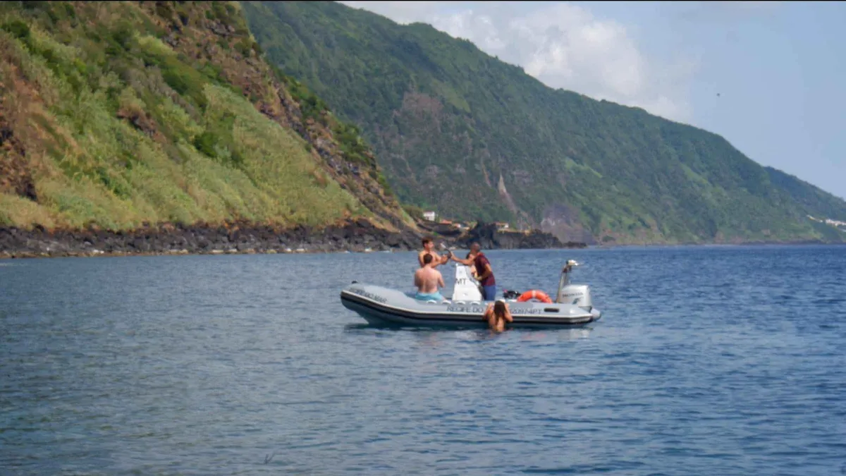
A full-day double act on Sao Jorge: the island's viewpoints, churches and a cheese factory by vehicle in the morning, then a boat trip along the coast in the afternoon, with lunch and chances to snorkel. Pickup covers the airport, Velas, Hotel Sao Jorge Garden and Calheta, and groups are capped at eight. Good for travelers who want the island's coast from the water as well as the road.
Check Availability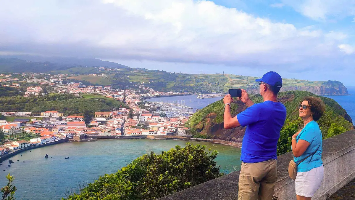 from $113.64
Full-Day Faial: Capelinhos, Caldeira & Local Guide
A full-day lap of Faial with local guide Ramiro, taking in the Caldeira, the Capelinhos volcano and quiet viewpoints at a relaxed pace, with hotel pickup, mineral water and a lunch option. The operator advises a waterproof jacket because the weather can change fast. Good for travelers who want one island explained by someone who lives on it.
Check Availability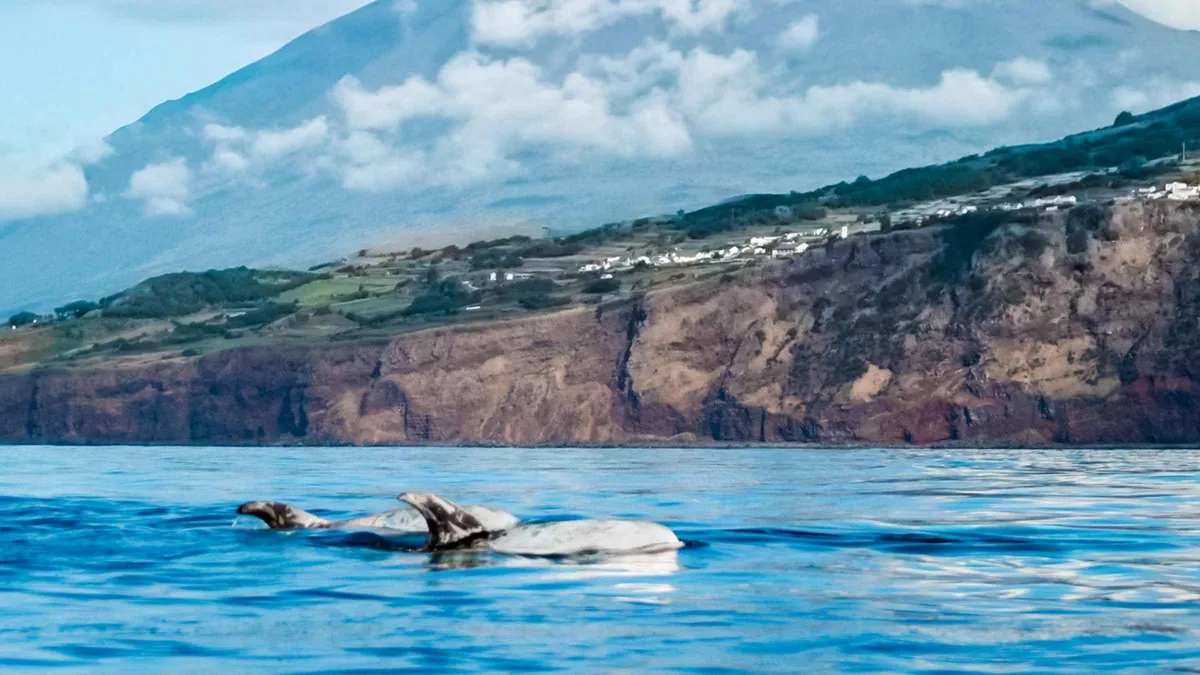 from $80.35
Pico Island: Whale Watching Experience from Lajes do Pico
A guided zodiac whale watching trip from Lajes do Pico with certified nature guides and marine biologists on board. Children under eight, pregnant travelers and people with back or heart problems are not admitted, and departures depend on weather and sea conditions. Good for travelers staying on Pico who want whale watching with expert eyes on board.
Check AvailabilityPrices, ratings and details are the platform's own. dollar figures are the listed prices — the platform bills in your account's currency.
How The Fajãs Formed
The fajãs are São Jorge's signature. Per the official trails pages, São Jorge's coastal platforms are detrital fajãs, several of them carrying coastal lagoons, and the fajãs of São Jorge are listed among the archipelago's distinctive volcanic features. So what is a fajã?
The word names a platform of fallen cliff material at the foot of the sea cliffs. When the island's volcanic slopes erode, rock and debris break away and pile up below, building flat ground between the steep ridge and the ocean. These colonies of flat land are the only real fields, orchards and settlements on an island that is otherwise a narrow spine.
Some fajãs lie at the end of roads that switchback down the cliff face, one hairpin after another, and a few of the platforms hold their own coastal lagoons where fresh and salt water mix. The most famous pair sits on the north coast: Fajã dos Cubres and Fajã da Caldeira de Santo Cristo. The Santo Cristo lagoon is classified as Protected Landscape and a place of cultural and scenic interest.
It is known for its clams, it is a habitat for resident and migrant birds, and it is a surf and bodyboard sanctuary. The practical consequence for any visitor is simple. The ridge road runs high along the spine and the fajãs sit at sea level, so every fajã visit is a descent followed by the same climb back, and the island's days are built around that rhythm.
What To See: Lagoons, Fajãs And The Ridge
Four stops cover the island's essentials, from the classified lagoon to the two ferry towns.
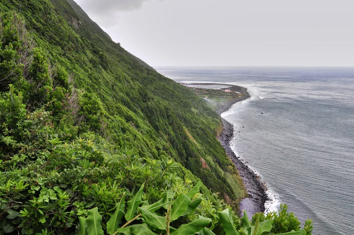
The north cliffs above the fajã. Photo: pedrik, CC BY 2.0, via Wikimedia Commons
Fajã da Caldeira de Santo Cristo
This is the one fajã with a national reputation, sitting at the foot of the north cliffs. Its lagoon is classified as Protected Landscape and a place of cultural and scenic interest per the official trail page. The lagoon is known for its clams, it is a habitat for resident and migrant birds, and it is described as a surf and bodyboard sanctuary.
You reach it on foot by the PR01SJO trail or by the cliff road that drops from the ridge. No entry fee is published and no hours apply, the platform is open ground.
Fajã dos Cubres
The classic postcard platform, connected by a causeway section, and paired with Santo Cristo on the official PR01SJO route. The official page states what matters: the fajã is the end point of the island's signature trail. No entry fee is published and no hours are published, so you arrive when the light and the tide suit you.
From the causeway you look back at the cliff wall and forward to the lagoon of Santo Cristo beyond.
The PR01SJO Route Between Them
Serra do Topo, Caldeira de Santo Cristo, Fajã dos Cubres: those are the three points of the official PR01SJO route. The published figures are 9.3 km, average time 2h30, difficulty Medium, and the route is linear. It is listed as active with no closure alert at the latest check.
GPX, KMZ and PDF downloads are on the official trail page, so you can navigate it exactly as the trail managers drew it.
Velas And Calheta
These are the two ferry ports and the practical gateways to the island. Velas sits on the south coast to the west, Calheta to the southeast on the same coast. No fee applies and no hours are published, because they are working towns whose harbours exist for the boats.
Between them they carry every arriving visitor, and Velas doubles as the island's main town for shops, accommodation and car rental pickups.
The Official Trails: Codes, Distances, Status
The official trails page publishes the codes and statuses, and this table lists the named routes.
The named routes
GPX, KMZ and PDF downloads are on the official page, and the remaining codes (PR02SJO, PR03SJO, PRC05SJO Fajã d'Além, PR09SJO) complete the list. Trail status changes, the alerts live on the official page, so check it the week you walk. For the archipelago-wide picture of codes and difficulties, see azores-hikes.
| Code | Route | Note |
|---|---|---|
| PR01SJO | Serra do Topo – Caldeira de Santo Cristo – Fajã dos Cubres | 9.3 km, average 2h30, Medium, linear, no closure alert at the latest check |
| PRC10SJO | Caminho das Fontes | On the official list |
| PRC08SJO | Fajãs do Toledo | On the official list |
| PRC06SJO | Norte Pequeno | On the official list, the village is its trailhead |
| PR04SJO | Pico do Pedro – Pico da Esperança – Fajã do Ouvidor | On the official list |
| GR01SJO and GR02SJO | The East and West grandes rotas | On the official list |
Access Hours, Ferry Check-In And Trail Alerts
No sight on the island keeps hours. The fajãs and viewpoints are open ground, and no official page publishes a fee for any of them, which is the honest answer most blogs dress up. What is published is Atlânticoline's check-in rules: vehicles check in up to 20 minutes before departure, passengers up to 10 minutes, hand luggage has a maximum of 60x50x25 cm and two volumes of checked luggage are allowed.
The timetable itself is a different matter. Atlânticoline publishes it as a dynamic search tool with date-specific itinerary-change notices, the site runs notices like an itinerary change on a named line for a named date, so no crossing time printed anywhere is a promise. The booking portal is booking.atlanticoline.pt.
On crowds, PR01SJO is the classic and everyone who walks the island walks it, so start early. The fajã roads are single-lane cliff descents where two cars meet slowly and reversing is normal, which stretches any schedule. Practical planning lives at getting around azores.
Getting To São Jorge: Ferry Velas Or Calheta, Or Flight
The island sits on the only ferry network in the archipelago, the triangle, with ports at Velas and Calheta, connected to the other triangle islands. But Atlânticoline publishes no static per-route fares and no crossing durations, only a dynamic search tool, so a visitor prices and times a crossing in the booking portal, not on a fare sheet. By air, São Jorge (SJZ) has no direct North America service, it is served from Lisbon and Porto only, unlike Terceira or the two far islands.
From Ponta Delgada there is no ferry at all, no Ponta Delgada port exists on the route list, so from the base island the move is a flight. Once on the island, rent a car or take the one full-day tour, because the fajã roads reward a confident driver and there is little published public transport to fall back on. Arrival logistics for the whole archipelago are at getting to the azores, and car options at azores car rental.
How Many Days São Jorge Needs
The only published duration is PR01SJO's average 2h30, everything else in this table is our estimate.
Plans by available time
The routings below are priced with the platform's own tour figure and the official trail page's one published duration, the 2h30 average for PR01SJO, with everything else our estimate.
| If you have | Do this | Money | Why |
|---|---|---|---|
| One day | The full-day tour with vehicle and boat | From $286.98 | The fajãs by road and the coast by boat, guided, in 8 hours |
| One day, self-guided | PR01SJO, the 9.3 km classic | No fee published | The island's signature walk, average 2h30 plus returns |
| Two days | Add the ridge viewpoint and a second fajã descent | No fee published | The ridge and the coast are different islands of experience |
| Three days | Add the grandes rotas sections | No fee published | GR01SJO and GR02SJO carry the island's length |
São Jorge In Dated Lines
-
Biosphere designation
The Fajãs de São Jorge enter the UNESCO biosphere framework as one of the region's four island biosphere reserves
regional government reference, designation year unverified
-
Ongoing
Atlânticoline runs date-specific itinerary-change notices on the triangle lines
atlanticoline.pt, schedules must be pulled live
-
Latest check
PR01SJO listed active with no closure alert
trails.visitazores.com
Sources: trails.visitazores.com and atlanticoline.pt.
Do And Do Not On São Jorge
Do
- Start PR01SJO early, it is the island's classic and the average 2h30 stretches in the heat.
- Check the official trail page the week you walk, alerts live there.
- Arrive at the ferry port early, vehicles 20 minutes before departure, passengers 10.
- Price the crossing in Atlânticoline's booking portal, no static fares exist.
- Book the full-day tour if you want the fajãs and the coast without driving the cliff roads yourself.
Don't
- Do not plan the ferry from a printed timetable, the lines change on dated notices.
- Do not expect an entry fee anywhere, none is published.
- Do not attempt every fajã road in one day, each is a cliff descent and a climb back.
- Do not look for a ferry from Ponta Delgada, no such port exists.
- Do not treat the Portuguese saint questions in search as island content, they are about Saint George.
Five Things Most Visitors Do Not Know About São Jorge
Little-known facts
- The fajãs are detrital, platforms of fallen cliff material rather than lava flows, and several carry their own coastal lagoons (trails.visitazores.com).
- The Caldeira de Santo Cristo lagoon is a classified Protected Landscape known for its clams, its resident and migrant birds, and a surf and bodyboard sanctuary (trails.visitazores.com).
- PR01SJO's official figures are 9.3 km and an average 2h30, Medium, linear, which is shorter than most blogs imply (trails.visitazores.com).
- The regional government counts Fajãs de São Jorge among the region's four island biosphere reserves, though the designation year is not published in the sources this site checks (portal references).
- The island has no direct North American flights, only Lisbon and Porto service, unlike Terceira, Flores or Santa Maria (flights.azoresairlines.pt).
São Jorge Map: The Ridge, The Fajãs, The Ports
Next From São Jorge
The mountain island
Portugal's highest point and the vineyard landscape: pico-island.
Triangle ferrySão Jorge Island Questions
Is São Jorge worth visiting?
Yes, if the fajãs are why you came to the Azores. No other island has them, a 56 km ridge with coastal platforms at its foot, and the classic walk between two of them is officially 9.3 km at an average 2h30, difficulty Medium. The honest limit is access: two ferry ports, Velas and Calheta, and cliff roads down to the platforms, so a single day tends to be a ridge day or a fajã day rather than both. Two days cover the signature walk plus a second descent and the viewpoints on the spine. São Jorge, Açores in Portuguese, is one of the nine islands of the Azores, an autonomous region of Portugal. Compare them side by side at islands to see where São Jorge fits a first trip.
What are the fajãs of São Jorge?
They are coastal platforms of fallen cliff material at the foot of the island's sea cliffs, and several of them carry their own coastal lagoons. The named pair on the north coast is Fajã dos Cubres and Fajã da Caldeira de Santo Cristo. The Santo Cristo lagoon is classified as Protected Landscape and a place of cultural and scenic interest, known for its clams, a habitat for resident and migrant birds, and a surf and bodyboard sanctuary. The official trail page pairs the two fajãs on the PR01SJO route. No entry fee is published for any of them, and no hours apply, so access is a matter of roads and trail alerts rather than tickets.
Why do search results ask which saint São Jorge protects?
The Portuguese questions Google surfaces, "Qual foi o milagre que São Jorge fez?", "São Jorge é o santo protetor de que?" and "São Jorge dia?", are about Saint George the saint, not about this island. This page is about the Azorean island of that name, a 56 km ridge in the central triangle, and the wrong-entity results are a known trap when researching it. If you came for island planning, ignore the saint pages and start from the trail codes and the ferry ports. Broader ideas for the archipelago are at things to do in the azores.
How do you get to São Jorge?
By triangle ferry to Velas or Calheta, priced inside Atlânticoline's booking portal at booking.atlanticoline.pt because no static fares or crossing durations are published, or by air. The airport code is SJZ, and the island is served from Lisbon and Porto only, with no direct North America service unlike Terceira or the far islands. From Ponta Delgada there is no ferry at all, no Ponta Delgada port exists on the route list, so from the base island the move is a flight. The triangle neighbours Faial and Pico are the shortest boat hops. Arrival planning for the whole archipelago is at getting to the azores.
How many days do you need in São Jorge?
Our estimate is two. One day for the PR01SJO classic between the fajãs, 9.3 km and an average 2h30, and one for the ridge viewpoints and a second fajã descent, since each descent ends with the climb back up. A single day works only as the guided full-day tour, which pairs the morning roads with an afternoon boat trip along the coast in 8 hours. The only duration the official pages publish is that 2h30 average for PR01SJO, so any multi-day plan is judgement rather than a sourced figure. Trail context for the whole archipelago is at azores-hikes.
Can you visit São Jorge without a car?
The ferry ports are walkable towns, but the fajãs sit at the end of single-lane cliff roads, and no public transport is published for them. The working car-free answers are the full-day tour with vehicle and boat, which covers the roads and the coast in one guided day, or basing at Velas and walking from the door. Keep in mind the ferry check-in rules if you do bring a vehicle, up to 20 minutes before departure for cars and 10 for passengers, with hand luggage capped at 60x50x25 cm. More car-free planning is at azores without a car.
São Jorge On Film
São Jorge, Azores: The Most Dramatic Roadtrip on Earth (Azores Ep. 1)
The ridge roads and cliff descents filmed as a drive.
Video: Leaving In 5'Fascinating Fajãs of Sāo Jorge - Azores
The coastal platforms explained from the air and the ground.
Video: TravelmaniaSao Jorge, Azores | 4K Drone | Views Of Serra Do Topo, Faja Da Caldeira Santo Cristo & Faja Do Belo
The PR01SJO landscape from above, useful before you walk it.
Video: TNT's Treks & TrailsVideos load from YouTube only when you press play.
We may earn a commission if you book through one of our links, at no extra cost to you. Full affiliate disclosure