 Guide to the Azores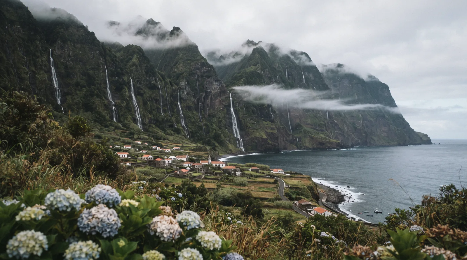
Flores Island Azores: Waterfalls At Europe's Edge
Flores Island, Azores, is the island the tourism board's own page describes with almost twenty waterfalls on the Fajãzinha to Fajã Grande coast, seven named crater lakes, a basalt cliff face that looks like a pipe organ, and the islet of Monchique, the westernmost piece of land of the European Continent. It is also the Azores' quiet edge, a Biosphere Reserve since 2009, reached by flight rather than ferry. This guide uses the official page's own names and numbers, flags the famous names the official page does not confirm, and prices the three tours that actually run here. Corvo sits next door at corvo island, the island comparison at islands, the whole site at the Guide to the Azores.
Quick answer Flores is the Azores' westernmost island, a UNESCO Biosphere Reserve confirmed in 2009.…
Flores is the Azores' westernmost island, a UNESCO Biosphere Reserve confirmed in 2009. Its official page counts almost twenty waterfalls on the Fajãzinha to Fajã Grande coast, with the Ribeira Grande stream standing out at 300 metres, plus seven crater lakes with Negra the deepest at 105 metres, the Rocha dos Bordões basalt columns, and the Monchique Islet, the westernmost piece of land of the European Continent.
Key takeaways
- No sight charges entry, so the money question is which tour. The full-day with lunch at $109.05 covers the island in 7 hours.
- The boat tour to the westernmost point of Europe runs 3 hours at $134.30 with a marine biologist.
- Reach it by flight. Boston, Toronto, Montreal and Halifax all serve FLW, and the ferry publishes no static schedule. See getting to the azores.
- The famous Poço da Ribeira do Ferreiro name is absent from the official page. This guide flags which names are official and which are not.
Key facts
Opening hours
| Landscapes and viewpoints (no gate, no ticket, no published hours) | 00:00–23:59 |
|---|---|
| Boat tours from the island (duration per listing, see the table below) | 00:00–00:00 |
Admission
- Adult
- No entry fee published for any sight on the island. Tours: full day $109.05, quad $177.92, boat $134.30
- Free
- Every named landscape on the official page is open ground
Planning it
- Time needed
- Not published for the landscapes. The full-day tour runs 7 hours, the boat tour 3, the quad 4
- Book ahead
- Optional — walk-up usually fine
- Address
- Santa Cruz das Flores is the main town and airport settlement, Flores
Flores Tours Compared
No entry-fee attraction exists on Flores, so the rows below are the platform's own listings plus the official landscape page. Conversions use €1 = $1.146.
Nothing on the island charges admission, so the money decision is which of the three tours matches how you want to move.
| Option | Price | Includes | Cancel | Book |
|---|---|---|---|---|
| Flores landscapes, official pageWalkers and drivers doing it themselves. The landscapes are open ground. | No fee published | The waterfall coast, the crater lakes, Rocha dos Bordões, the Monchique islet viewpoint | Nothing to cancel | Official site |
| Flores Island: Full-Day Guided Tour with LunchFirst-time visitors with one day. The default. | From $109.05 | 7 hours, local guide, transport and lunch included, 4.9 from 117 reviews | Operator's policy on the listing | Check Availability |
| Flores Island: Quad Bike TourRiders who want the lagoons and viewpoints with the fun factor. | From $177.92 | 4 hours on a quad, viewpoints and lagoons, 5 from 7 reviews | Operator's policy on the listing | Check Availability |
| Flores Island Boat tour: Westernmost Point of EuropeAnyone who wants Europe's westernmost point from the water. | From $134.30 | 3 hours with a marine biologist, cliffs and waterfalls from the sea, 5 from 1 review | Operator's policy on the listing | Check Availability |
Every named landscape on the island is free open ground, so the only priced rows are the platform's three Flores listings, and their prices, ratings and durations are the platform's own. in Q3 2026
Flores Tours Worth Booking
These are the island's dedicated listings on the platform, and the figures shown are the platform's own.
 from $109.05
Small group
from $109.05
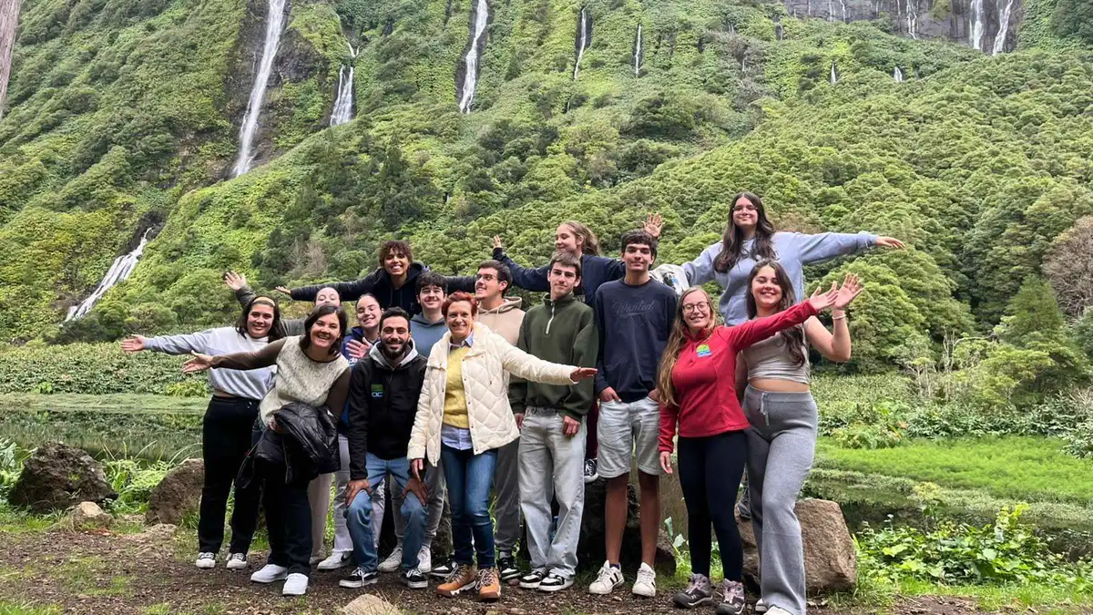
Small group Flores Island: Full-Day Guided Tour with Lunch
A seven-hour loop of Flores with a certified local guide, stopping at seven lakes, waterfalls and panoramic viewpoints, with lunch, hotel pickup anywhere on the island, and child seats available. The operator reschedules once for free if fog or reduced visibility closes in. Good for travelers who want the island's big scenery handled door to door.
Check Availability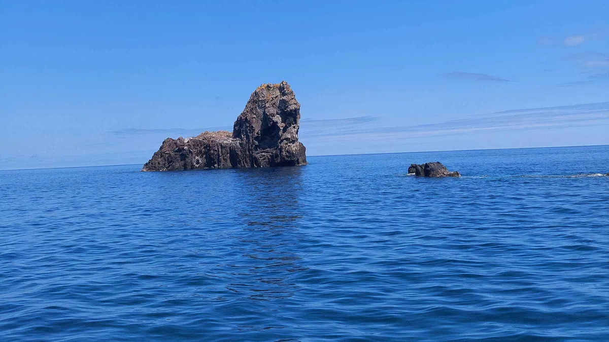 from $134.30
Small group
from $134.30
Small group Flores Island Boat tour: Westernmost Point of Europe
A three-hour boat circuit of Flores with a marine biologist, running the full coastline to the Monchique Islet, the westernmost point of Europe, past cliffs, waterfalls and volcanic formations. Groups are capped at five. Good for travelers who want the island's wild side from the water and the biology explained.
Check Availability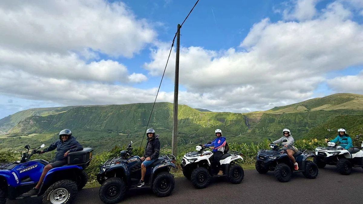 from $177.92
Small group
from $177.92
Small group Flores Island: Quad Bike Tour
A four-hour guided quad bike loop of roughly 30 km across Flores' lagoons and viewpoints, with helmet, fuel, insurance and a driving briefing included. Every driver needs a valid driver's license accepted in Portugal and signs a liability waiver, and the group is capped at eight. Good for travelers who want to add motion to their Flores day and are licensed to ride.
Check AvailabilityPrices, ratings and details are the platform's own. dollar figures are the listed prices — the platform bills in your account's currency.
A Biosphere Island At Europe's Edge
UNESCO confirmed Flores as a Biosphere Reserve in 2009, after Corvo and Graciosa took the title in 2007. The geography explains the protection. This is the westernmost island of the archipelago, close enough to the edge of the European continent that its islet of Monchique carries the title of westernmost piece of land of the European Continent, per the official page.
The island's interior is a plateau of crater lakes, seven of them named on the official page, and its coast falls away in cliffs that turn every stream into a waterfall, almost twenty of them on one stretch alone. That combination of high wet plateau and vertical coast is why the whole island earned the designation rather than a single site. The practical frame for a visitor is simple.
Distances are short, roads are few, and the weather moves fast, so the island rewards one good loop done slowly rather than a checklist. The official island page treats the waterfalls, the lakes and the basalt columns as one continuous landscape, and that is how you should drive it. For how the nine islands compare, see islands.
What To See: Waterfalls, Lakes And Basalt Columns
Four sights carry the island, and each one has a name question worth settling before you go.
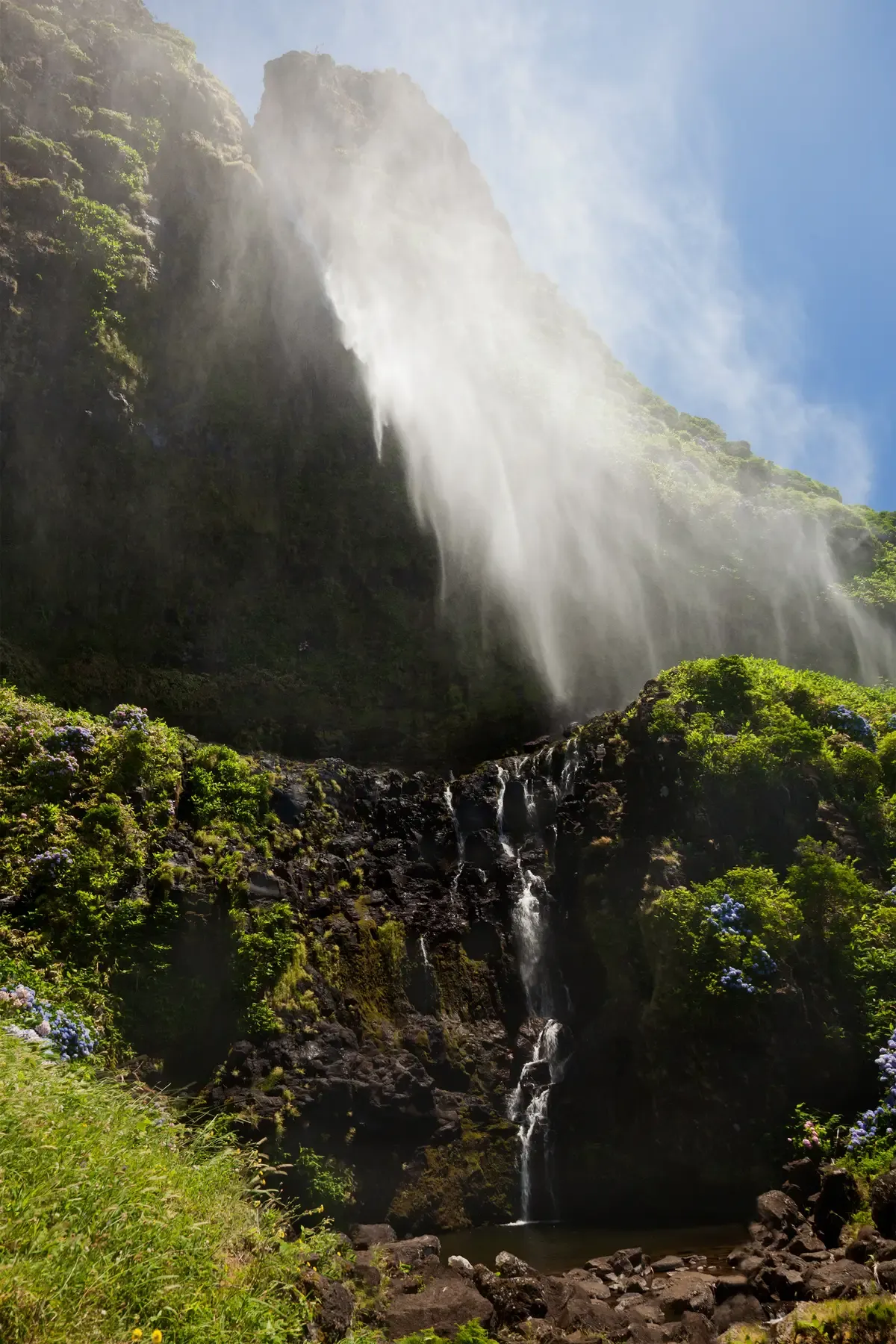
Poço do Bacalhau, one of the coast's named pools. Photo: Unukorno, CC BY-SA 3.0, via Wikimedia Commons
The Fajãzinha to Fajã Grande waterfall coast
This is the island's signature. Per the official page, almost twenty waterfalls fall on the stretch of coast between the villages of Fajãzinha and Fajã Grande on the island's west, with the Ribeira Grande stream standing out at 300 metres of height. The named pools at the bottom of the falls are Poço do Bacalhau and Poço da Alagoinha, the latter also known as Lagoa dos Patos.
Now the name question. The photo spot travellers call Poço da Ribeira do Ferreiro is not named anywhere on the official page, so treat that famous label as an unofficial name travellers use and stick to the official framing when you plan or navigate.
The seven crater lakes
The island's interior is a plateau dotted with crater lakes, and the official page names all seven individually: Caldeira Rasa, Funda, Branca, Seca, Comprida, Negra and da Lomba. Negra is the deepest at 105 metres. The collective name Lagoa das Sete Lagoas circulates on travel sites, but it is not the official page's framing, so this guide prints the seven names and nothing else.
The lakes sit at height on the plateau, which means cloud decides your view more than any timetable does. A clear window after rain is the moment.
Rocha dos Bordões
A large set of vertical basalt columns whose prismatic or columnar jointing, in the official page's words, resembles a pipe organ. It is a roadside sight on the west of the island, and no fee is published for viewing it. You do not hike to it, you pull over, and the columns fill the frame above the road.
Pair it with the Fajãzinha to Fajã Grande drive and the same loop takes in the waterfall coast in one go.
Ilhéu de Monchique
The islet off Flores' west coast that the official page names as the westernmost piece of land of the European Continent. You see it from the coast or from the boat tour, you do not walk on it. One correction worth carrying: it is not the same point as the "Ponta do Albernaz" name some blogs use.
The official name is the Monchique Islet, and blogs mix the two up. The 3-hour boat trip with a marine biologist is the way most visitors actually put Europe's edge in a photo.
The Waterfall Coast And Its Pools
The official geography first. The Fajãzinha to Fajã Grande coast on the island's west carries the falls, almost twenty of them on one stretch, with the Ribeira Grande stream dropping 300 metres. The two named pools, Poço do Bacalhau and Poço da Alagoinha, the latter also known as Lagoa dos Patos, sit at the bottom of falls near Fajã Grande.
Now what is not published. No official page prints hours, fees or swimming rules for any pool. The landscapes are open ground with no gate and no ticket, and no walking time or distance is published for the coast paths, so this guide prints none.
Practical notes instead. The road between Fajãzinha and Fajã Grande is the island's single best drive, short enough to repeat and worth doing twice. The car park at Fajã Grande is small, so arrive before the middle of the day.
Morning light suits the cliff wall best, when the falls catch the sun before the cloud builds over the plateau. Rain, which is frequent here, multiplies the falls, so a wet forecast on this coast is a feature and not a failure. If you want to extend the day on foot, the walking context lives at azores-hikes.
What Is Open When (Mostly Nothing Is Ticketed)
The negative findings first, because they save you planning time. No sight on Flores publishes an entry fee, no landscape publishes hours, and no official page names a season for the hydrangeas that appear in every photograph of the island, so this guide prints no bloom window either. The landscapes are open ground, all hours, all year.
What does have a schedule is short and knowable. The three tours do: the full day runs 7 hours, the boat tour 3, the quad 4. The flight pattern into FLW sets when people arrive and leave.
And in summer the boat berths run on a rhythm of their own, so the boat tour fills around the slots. Crowds are the mildest in the archipelago. Flores is the region's quiet edge, and the pinch points are specific: the small Fajã Grande car park in the middle of the day, and the summer boat slots.
The real gatekeeper is the weather. Cloudbanks cross the plateau fast, and a lake you cannot see is not a sight. So sequence the day around it: do the coast in the morning, the lakes when the cloud lifts.
The weather patterns behind this advice are at azores-weather.
Getting To Flores: FLW Flights And The Long Ferry
The practical way in is a flight. Azores Airlines sells Boston to Flores (FLW), Toronto and Montreal to FLW, and Halifax to FLW, so the island has its own North America service, which is rare in the archipelago. Inter-island, the move is a SATA or Azores Airlines flight, not a boat.
The alternative, the sea route, is honest work. Atlânticoline lists Santa Cruz das Flores as a port on its longest lines, but publishes no static long-route schedule, only a dynamic search tool with dated itinerary notices. That means a ferry day exists only when the search tool offers one, and never as a standing timetable.
There is no Ponta Delgada ferry port, so Flores is never a ferry hop from São Miguel, it is a flight. Treat any plan built on a fixed boat schedule as a plan that can fail. On the island itself, the airport sits at the main town, Santa Cruz das Flores, and the sights spread west from there, so a hire car or a tour is the working pattern for the waterfall coast and the plateau lakes.
The full routing picture is at getting to the azores and the car question at azores car rental.
How Many Days Flores Needs
The only published durations on the island are the three tours'. Everything else in this table is our estimate.
Time and money by stay length
Pick the row that matches your stay. The tour prices are the platform's own and the half-day and three-day patterns are our estimate.
| If you have | Do this | Money | Why |
|---|---|---|---|
| Half a day | The waterfall coast drive to Fajã Grande | $0, no fee published | Almost twenty falls on one road, the island's signature |
| One day | The full-day guided tour with lunch | From $109.05 | 7 hours covers the lakes, the columns and the coast with a local |
| Two days | Add the boat to the westernmost point | From $134.30 | Monchique and the cliffs read best from the water, 3 hours |
| Three days | Add the quad tour or a second weather window | From $177.92 | The plateau lakes need a clear window, keep a spare day |
Flores In Dated Lines
-
2007
Corvo and Graciosa become the region's first biosphere islands
unesco.org/mab, visitazores.com
-
2009
UNESCO confirms Flores as a Biosphere Reserve
unesco.org/mab, visitazores.com
-
Ongoing
Atlânticoline runs the long lines to Santa Cruz with dated itinerary notices, no static schedule
atlanticoline.pt
-
Latest check
Azores Airlines lists Boston, Toronto, Montreal and Halifax service to FLW
flights.azoresairlines.pt
Sources: visitazores.com, atlanticoline.pt, flights.azoresairlines.pt.
Do And Do Not On Flores
Do
- Drive the Fajãzinha to Fajã Grande road in the morning, the cliff wall is the island's signature
- Keep a spare day for the crater lakes, the plateau cloud moves and a clear window decides it
- Take the boat tour for Monchique, Europe's westernmost land reads best from the water
- Check the flight into FLW rather than a ferry plan, the long lines publish no static schedule
- Book the full-day tour on a short stay, it folds the island's sights into 7 hours with lunch
Don't
- Do not plan around hydrangea bloom dates, none is published officially
- Do not trust a fixed ferry schedule to Flores, the timetable is a live search tool
- Do not look for Poço da Ribeira do Ferreiro on the official page, the name is not there, the coast's official names are Ribeira Grande, Poço do Bacalhau and Poço da Alagoinha
- Do not expect entry fees, none exists, and do not pay anyone for a viewpoint
- Do not treat Corvo as an afterthought, it pairs naturally and its page is corvo island
Five Things Most Visitors Do Not Know About Flores
- The official page counts almost twenty waterfalls on the Fajãzinha to Fajã Grande coast alone, with Ribeira Grande standing out at 300 metres (visitazores.com).
- The island has seven named crater lakes, and the deepest, Negra, runs 105 metres (visitazores.com).
- The Monchique Islet, not any point on the main island, is the official westernmost piece of land of the European Continent (visitazores.com).
- The famous photo-spot name Poço da Ribeira do Ferreiro appears nowhere on the official island page, it is an unofficial label travellers use (visitazores.com, name absent).
- The island has its own North America flights, Boston, Toronto, Montreal and Halifax to FLW, which most island-hoppers never use (flights.azoresairlines.pt).
Flores Map: The Waterfall Coast, The Lakes, Monchique
Next From Flores
The smallest island
The Caldeirão lake and Vila do Corvo: corvo island.
Short flight or the long ferry lineWhales from the water
The boat context, seasons and species: whale watching azores.
From the same coastFlores Island Questions
Is Flores, Azores worth visiting?
Yes, if waterfalls and wild coast are the point of the trip. The official page counts almost twenty falls on one stretch of the Fajãzinha to Fajã Grande coast, seven named crater lakes with Negra 105 metres deep, and Europe's westernmost land at the Monchique Islet. No sight on the island charges entry, so the landscapes themselves cost nothing. The honest cost is access. The island sits at the end of a flight, not a ferry hop, so you pay for the transfer and the quiet. How it weighs against the other eight islands is on the islands page.
How do I get to Flores Island in Azores?
Fly. Azores Airlines sells Boston, Toronto, Montreal and Halifax to Flores (FLW), a North America service few islands in the archipelago have. The inter-island move from other islands is a SATA or Azores Airlines flight. The ferry exists on Atlânticoline's longest lines, with Santa Cruz listed as a port, but no static schedule is published, only a dynamic search tool with dated itinerary notices. That makes the boat a when-the-tool-offers-it option, never a plan. The full routing picture is on the getting to the azores page.
How many days do you need in Flores?
Our estimate is two full days. Day one is the waterfall coast and Fajã Grande, the road the official page counts almost twenty falls on. Day two is the crater lakes and Rocha dos Bordões on the plateau, where a clear weather window decides the views. If you have neither a car nor the time, the full-day guided tour folds day one into 7 hours with transport and lunch included. Walking options to stretch the stay are on the azores-hikes page.
Where is the westernmost point of Europe?
The Monchique Islet off Flores' west coast, which the official page names as the westernmost piece of land of the European Continent. It is an islet, so you see it from the coast or from the water, you do not walk on it. The boat tour that covers it runs 3 hours at $134.30 with a marine biologist, reading the island's cliffs and waterfalls from the sea on the way out. One correction worth repeating: it is not the "Ponta do Albernaz" point some sites name, that label mixes up two different places.
Can you visit Corvo from Flores?
That is the natural pairing. Corvo sits a short flight or a long ferry line away, and its Caldeirão lake, a crater lake with a cluster of small volcanic cones inside, is a half-day visit on an island of about 17 square kilometres. The details and the honest transport picture, including how the ferry schedule actually works between the two, are on the corvo island page. The wider transport context across the archipelago is on getting around azores.
When do the hydrangeas bloom in Flores?
No official page publishes bloom dates. The hydrangeas appear in the tourism material without a season attached, and no official source names a window, so this guide prints no dates either. The safe framing is the general Azorean pattern of colour in high summer, which is an inference and not a published fact. Plan the trip around the weather instead, since the plateau cloud decides your lake views more than the flowers decide anything. The climate context lives on the azores weather page.
Flores On Film
6 Days on Europe's Most Remote Island – Flores, Azores
A week on the island at walking pace, the honest preview.
Video: Backpacker FelipeThe HAWAII of EUROPE (Flores Island)
The waterfall coast and pools filmed up close.
Video: Be My Travel MuseFLORES - arguably the most beautiful island of the AZORES
The lakes and the west coast in one drive-along.
Video: Pin Your Footsteps - Travel BlogVideos load from YouTube only when you press play.
We may earn a commission if you book through one of our links, at no extra cost to you. Full affiliate disclosure