 Guide to the Azores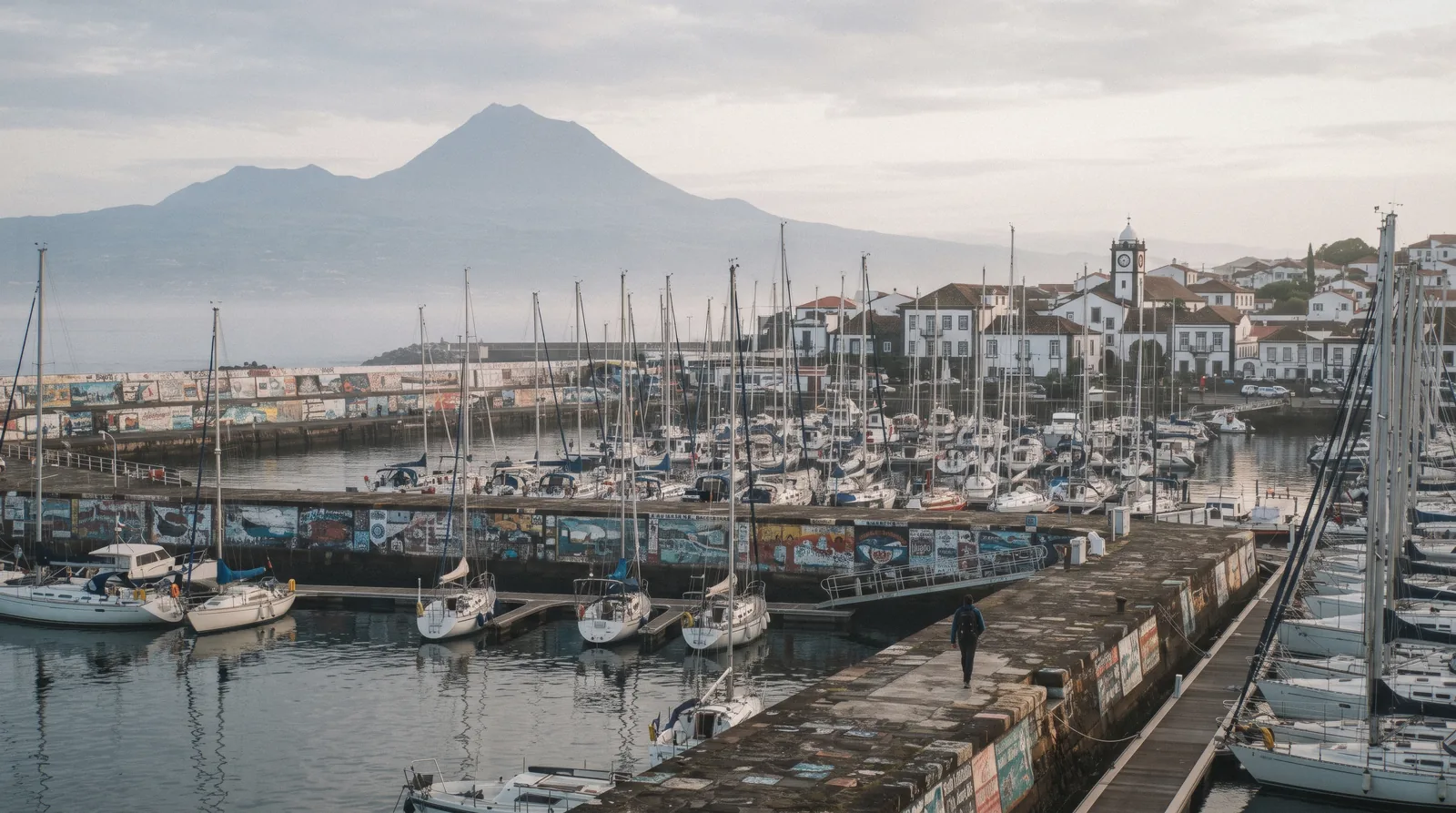
Azores Map: The Nine Islands, Pinned From Sources
This Azores map pins only what official sources can locate: the nine islands, the ferry ports, the airports and the sights with published facts. Each pin carries a note, and prices where an official figure exists. Start with the plan guide, or move through the full Guide to the Azores island by island.
Quick answer The nine islands, ports, airports and pins
The Azores map shows nine volcanic islands spread across roughly three transport zones in the mid-Atlantic, part of Portugal, with João Paulo II airport (PDL) at Ponta Delgada as the gateway and direct flights from Boston, New York, Toronto and Montreal. Ferries touch only Faial, Pico and São Jorge. The map below pins what official sources can locate, and explains why the rest stays unpinned.
Key takeaways
- The nine islands split into a São Miguel base, the ferry triangle, the central flight group and the far islands. Compare them all on the islands overview.
- PDL receives direct flights from Boston, New York, Toronto and Montreal. The routes are listed in getting to the Azores.
- On São Miguel, a full-day all-in-one tour covers the classic pins in eight hours for $91.83 (4.9, 184 reviews) with tour-25.
The Azores, Pinned
Four colours for four transport zones: the São Miguel base, the ferry triangle, the central flight group and the far islands. Pins carry a note each, and prices where an official one is published.
São Miguel base 15 pins
- João Paulo II Airport (PDL)The gateway airport of the Azores, west of Ponta Delgada town. Direct listings include Boston, New York, Toronto and Montreal.
- Ponta DelgadaThe capital and the tourist-tax town, with the Portas da Cidade and the marina in walking distance of the bus hub.
- Mercado da GraçaThe 1848 municipal market on Rua do Mercado, closed Sundays and open to early shoppers the rest of the week.
- Miradouro da Vista do ReiFreeThe trailhead of the 6 km Vista do Rei walk into Sete Cidades village, named for the royal visit of 1901.
- Sete Cidades villageThe village inside the crater, the end point of the classic walk and the nearest bus turn-around to the lakes.
- Lagoa do Fogo viewpoint$9.17 (€8) shuttleThe crater lake both shuttle lines serve. In season the road up is closed to private cars, so the bus is the way in.
- Caldeira Velha$11.46 (€10.00)Thermal pools under a small waterfall on the north flank of Fogo, on timed 90-minute tickets with a 100-bather cap.
- FurnasThe valley inside a volcano, with the fumarole fields on the lake shore and the town of thermal pools.
- Parque Terra Nostra$19.48 (€17.00)The iron-orange thermal tank inside a historic garden, open 10:30 to 16:30 daily with online tickets released 15 days ahead.
- Poça da Dona Beija$13.75 (€12)Four ferrous pools at about 39 °C, open 08:30 to 23:00, online sales only with a 1h30 maximum stay.
- Gorreana tea factoryFreeEurope's oldest tea plantation by its own claim, working since 1883. Visits and tastings are free with no booking.
- Arruda pineapple greenhousesFreeThe PGI pineapple glasshouses of Fajã de Baixo, free to walk every day with a free tasting at the shop.
- Ilhéu de Vila FrancaThe flooded crater islet off Vila Franca, a protected area reached by the club boat in a 12 June to 11 October season under strict daily caps.
- Ribeira GrandeThe north coast town at the foot of the Fogo road, and the practical base for Caldeira Velha.
- NordesteThe wild east, with the free Ribeira dos Caldeirões waterfall park and the cliff viewpoints of Santa Iria and Ponta do Sossego.
Ferry triangle 7 pins
- HortaFaial's port and the west corner of the ferry triangle, with the sailors' Peter Café Sport and its Scrimshaw Museum at the marina.
- Peter Café Sport$4.01 (€3.50) museumThe bar at coordinates N 38°32' W 28°38', as printed on its own site, closed-museum Sundays included.
- MadalenaPico's port facing Horta, and the landing point for the UNESCO vineyard landscape that starts at the shore.
- Lajes do PicoThe whaling heritage town on Pico's south coast, now a whale-watching departure point in the sanctuary waters.
- Mount PicoIn the booking appPortugal's highest point at 2350 m by the official figure, climbed by reservation with an autonomous category that needs no guide.
- VelasSão Jorge's main ferry port, the entry for the fajãs and the 9.3 km Serra do Topo walk.
- CalhetaSão Jorge's second ferry port, on the south coast below the cliff-top ridges.
Central and Terceira 6 pins
- Angra do HeroísmoTerceira's UNESCO-listed central zone, inscribed in 1983, and the island's main city.
- Praia da VitóriaTerceira's second city and ferry port, next to the island's airport.
- Algar do Carvão$11.46 (€10.00)A volcanic chimney descended by 338 steps to a lake 90 m down, one of only three sites here that publishes its own GPS.
- Gruta do Natal$10.31 (€9.00)A lava tube visited with helmet and briefing at above 90% humidity, capacity 80 people, the second published-GPS site.
- Furna do Enxofre$4.01 (€3.50)Graciosa's domed cave with a lake at the bottom of the caldera, reached down a 183-step spiral tower.
- Vila da PraiaGraciosa's ferry port on the 10-port Atlânticoline list, the island's link into the network.
Far islands 3 pins
- Santa Cruz das FloresFlores' town and one of the two far-island ports, close to the waterfall coast of Fajãzinha and Fajã Grande.
- Vila do CorvoThe only town on the smallest island, 17.1 km² with 430 residents at the last census, facing the Caldeirão crater.
- Vila do PortoSanta Maria's main town on the oldest and southernmost island, formed about 10 million years ago.
Pin coordinates are port, town or venue level. Only Algar do Carvão, Gruta do Natal and Peter Café Sport publish their own coordinates, so the rest are located by their towns and ports, not by invented venue GPS.
The Nine Islands, Grouped the Way You Travel
The base: São Miguel
-
São Miguel
The largest island and the transport base, holding the gateway airport, the capital and the classic sights.
Tip: Start here unless you have a specific island reason not to.
The ferry triangle
-
Faial
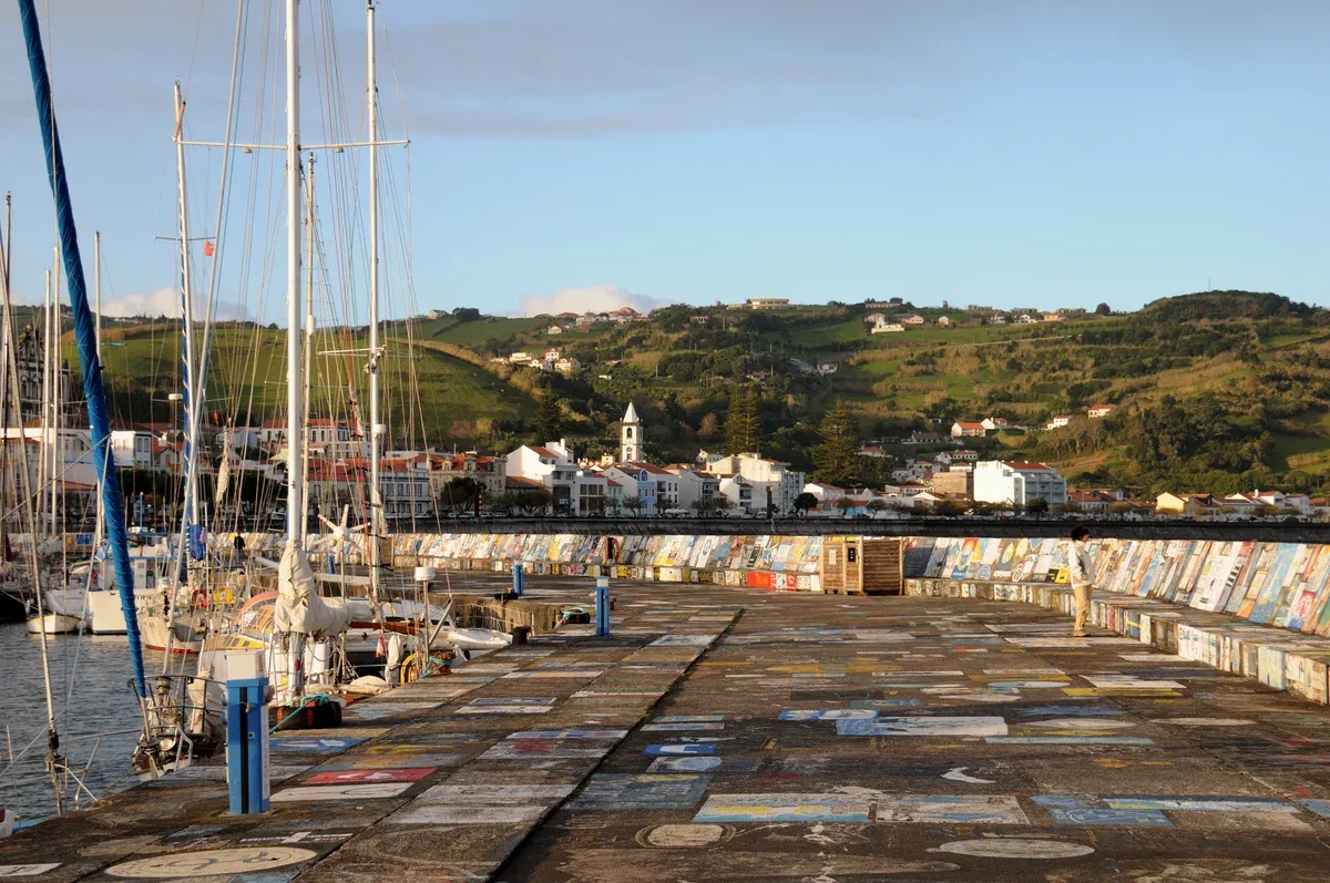
Horta's port town, the marina of painted yacht portraits and the Capelinhos volcano at the island's west end.
Tip: The triangle's west corner, Horta's port and the Capelinhos volcano.
-
Pico
The mountain island with the UNESCO vineyard shore at Madalena and whale watching from Lajes do Pico.
Tip: The mountain island, 2350 m, with the UNESCO vineyard shore.
-
São Jorge
A long ridge island of coastal fajãs, with ferry ports at Velas and Calheta and the 9.3 km Serra do Topo walk.
Tip: The long ridge island of fajãs, ferry ports at Velas and Calheta.
Terceira and Graciosa
-
Terceira
Home to Angra do Heroísmo, the UNESCO central zone, plus the lava chimneys of Algar do Carvão and Gruta do Natal inland.
Tip: Angra do Heroísmo's UNESCO centre and the lava chimneys inland.
-
Graciosa
A gentle island whose caldeira holds the Furna do Enxofre dome, reached down a 183-step spiral tower.
Tip: The gentle island with the Furna do Enxofre dome inside its caldeira.
The far islands
-
Flores
Waterfalls along the Fajãzinha coast, seven crater lakes and the Ilhéu de Monchique, the westernmost land of Europe.
Tip: Waterfalls, crater lakes and the westernmost land of Europe at Ilhéu de Monchique.
-
Corvo
The smallest island at 17.1 km² with one town and the Caldeirão crater, its interior lake ringed by small cones.
Tip: The smallest island, one town, the Caldeirão crater and the night sky.
-
Santa Maria
The oldest island, formed about 10 million years ago, with the warmest beaches and the Anjos chapel of the 1493 landfall.
Tip: The oldest island, the warmest beaches and the first landfall of 1493.
Numbers match the list — tap a pin for the guide.
The Five Pins Worth Building a Day Around
Most pins reward an hour or a stop. This shortlist, drawn from the sourced facts above, names the five that repay a whole day of an itinerary.
| The pin | The island | Why it earns a day |
|---|---|---|
| Sete Cidades and the Vista do Rei walk | São Miguel | A 6 km, 2h easy walk into the crater plus the free visitor centre |
| Furnas valley | São Miguel | Thermal pools, fumarole fields and the CIAF centre in one valley |
| Mount Pico | Pico | The 2350 m summit of Portugal, climbed by reservation |
| Angra do Heroísmo | Terceira | The UNESCO central zone of 1983 with the island's tours |
| Algar do Carvão | Terceira | The 338-step chimney, one of the three sites that publish GPS |
Pin prices and seasonal states compared on this page in Q3 2026, at the ECB rate of the research pass.
What the Colours Encode
Four colours, four transport realities
The map's categories exist for logistics, not looks. The green base pins sit on one island with buses, shuttles and day tours. The red triangle pins connect by Atlânticoline boats.
The dark central pins need a flight to Terceira or a ferry line from the triangle, and Graciosa reaches the network by boat. The brown far pins are flight-only in practice. Work out the sequence in getting around, or read how to see the islands without a car.
| Colour | Transport reality |
|---|---|
| São Miguel base (green) | Buses, the seasonal Fogo shuttle, day tours and one island's worth of driving |
| Ferry triangle (red) | Atlânticoline boats link Horta, Madalena, Lajes, Velas and Calheta |
| Central and Terceira (dark) | Flights from Ponta Delgada, plus Graciosa's Vila da Praia port on the Atlânticoline list |
| Far islands (brown) | Flights only in practice, with ports at Santa Cruz das Flores, Vila do Corvo and Vila do Porto |
Why the Map Spreads the Way It Does
Three groups, west to east
The archipelago falls into three groups running west to east. Santa Maria sits nearest the east and is the oldest island, formed about 10 million years ago. Corvo and Flores lie farthest west.
The central group, with the triangle islands, Terceira and Graciosa, holds the middle. Two facts to carry: the islands sit 1 hour behind mainland Portugal, an offset documented on Wikipedia only with no official source publishing it, so timetables printed in Lisbon time differ. And Corvo's Caldeirão crater spans 2.3 km across and 305 m deep, holding a shallow lake and small cones said to outline the drawing of the islands themselves.
More geometry is on the islands overview.
| Island fact | The figure |
|---|---|
| Islands in the archipelago | Nine |
| Corvo, the smallest island | 17.1 km² with 430 residents at the 2011 census |
| São Jorge, the ridge island | 56 km long, 6 to 8 km wide, 246 km² |
| Graciosa's caldeira | The smallest central volcanic structure, 1.6 to 0.8 km across with a 405 m rim |
| Mount Pico | 2350 m, the highest point of Portugal by the official figure |
Ports, Airports and the Ferry Gap
Ten ferry ports, one gap
Atlânticoline lists ten ports: Horta on Faial, Madalena and Cais do Pico on Pico, Velas and Calheta on São Jorge, Angra do Heroísmo and Praia da Vitória on Terceira, Vila da Praia on Graciosa, Santa Cruz on Flores and Vila do Corvo. No São Miguel port appears in that list, so the ferry map never touches the green zone. Everything beyond the triangle runs on SATA Air Açores and Azores Airlines, with PDL as the gateway and direct North American listings from Boston, New York, Toronto and Montreal.
Route detail is in getting to the Azores.
| Connection | The documented state |
|---|---|
| Ferry ports on the network | Ten, all in the central and western groups |
| São Miguel ferry link | No Ponta Delgada port appears on the Atlânticoline route list |
| PDL air gateway | Direct listings from Boston, New York, Toronto and Montreal, plus Lisbon, Porto and European cities |
| Islands without North American flights | São Jorge (SJZ) and Graciosa (GRW), served from Lisbon and Porto only |
| North American routes beyond PDL | Boston to Terceira, Santa Maria, Pico, Horta and Flores, and Toronto and Montreal to TER, PIX, HOR, FLW and CVU |
The Gaps on This Map, and Why Each One Is a Finding
What is deliberately not pinned
Most Azores venues publish no GPS as text. Only Algar do Carvão, Gruta do Natal and Peter Café Sport print their own coordinates, so every other venue pin sits at its town or port rather than at an invented door position. The Ferraria spa publishes no location details, hours or prices.
The Vila Franca islet boat price lives only inside the CNVFC booking flow. Several official viewpoint pages sit behind bot walls and could not be fully read. The Pico climb price lives inside the booking app.
A map that pinned guesses would be worse than a map that explains its blanks. See how we handle it on Caldeira Velha and Vila Franca do Campo.
| The blank | Why it stays blank |
|---|---|
| Venue GPS coordinates | No venue except three publishes coordinates as text, so pins sit at town or port level |
| Ferraria spa | The official pages publish no location details, hours or prices |
| Islet boat price | It appears only inside the CNVFC booking flow, not on any open page |
| Some viewpoint pages | Official parks pages sit behind bot walls, so details could not be verified |
| Mount Pico climb price | Shown only inside the official reservation app, never on a fetchable page |
Which Pins Carry a Price, and Which Refuse To
The pin prices come from official ticket pages where they exist, converted at the ECB rate. Reading them as a layer of the map tells you where a day costs nothing and where the booking app is the only counter.
The free pins
Gorreana's factory circuit, the Arruda greenhouses, the Vista do Rei trailhead and every viewpoint on the parks network cost nothing, and the Nordeste waterfall park is always open and free. That cluster alone fills a car-free day on São Miguel.
The priced pins
The published tickets run from $3.44 (€3.00) at the Furnas interpretation centre to $19.48 (€17.00) at Parque Terra Nostra, with the Terceira caves at $11.46 (€10.00) and $10.31 (€9.00) and the two museum-scale entries at $4.01 (€3.50). The full fee table lives on azores costs.
The pins with no published price
Mount Pico's climb price shows only inside the booking application. The Vila Franca islet boat price appears only inside the club's booking flow. The Ferraria spa publishes no prices at all.
The Capelinhos centre's official page blocks readers and third-party figures conflict. None of these blanks gets invented here; each is a finding about how the venue sells.
| Pin | The published state |
|---|---|
| Mount Pico | Price only inside the reservation application |
| Ilhéu de Vila Franca | Boat price inside the CNVFC booking flow, caps of 400 a day and 200 on the islet |
| Ponta da Ferraria | No published hours, prices or booking, low tide is the only schedule |
| Capelinhos centre | Official page blocks readers, third-party figures conflict |
| Shuttle Vulcão do Fogo | $9.17 (€8) adult, published on the regional tourism portal |
What the Season Changes on the Map
Pins that move with the calendar
The islet boat runs in a 12 June to 11 October 2026 season with a 400-visitor daily cap. The Fogo shuttle operates 1 August to 30 September, and while it runs the road up is closed to private cars. The Sete Cidades visitor centre closes weekends from 1 November.
Caldeira Velha moves to winter hours of 09:00 to 17:00 from 1 November.
| Pin | Seasonal state |
|---|---|
| Ilhéu de Vila Franca | Boat season 12 June to 11 October 2026, 400 visitors per day, 200 on the islet at once |
| Lagoa do Fogo viewpoint | Shuttle season 1 August to 30 September, road closed to private cars while it runs |
| Sete Cidades visitor centre | Free entry, weekends closed from 1 November |
| Caldeira Velha | Winter hours 09:00 to 17:00 from 1 November, timed 90-minute slots |
Pin It, Then Plan It
The map as a routing tool
The colour zones are already routes. A car-free week can hold one São Miguel base, two triangle days stitched by ferry and one flight day to Terceira. If you would rather hand over the keys, the private all-island day at $227.28 (tour-24) or the group all-in-one day at $91.83 (tour-25) covers the green pins in a single eight-hour run.
Fit the pieces together in plan and the islands overview. The published durations make the routing arithmetic honest: the Vista do Rei walk is 2 hours, the CIAF guided visit runs 45 minutes by prior booking, the Furna do Enxofre guided visit runs 40 to 60 minutes, and Algar do Carvão takes about half an hour inside, which is enough to know a triangle day fits three pins and a base day fits two.
| Trip shape | The documented day |
|---|---|
| Base day, no car | Vista do Rei walk (2h) into Sete Cidades, visitor centre after |
| Valley day | Furnas: Terra Nostra or Dona Beija plus the CIAF guided visit (45 min) |
| Triangle day | Ferry to Madalena, Pico's vineyard shore or the 338-step chimney (~30 min inside) |
Days That Cover the Pins
Two eight-hour days that turn the green pins into a plan without a car.
 from $91.83
Small group
from $91.83
Small group São Miguel Island: Full Day All-in-One Tour
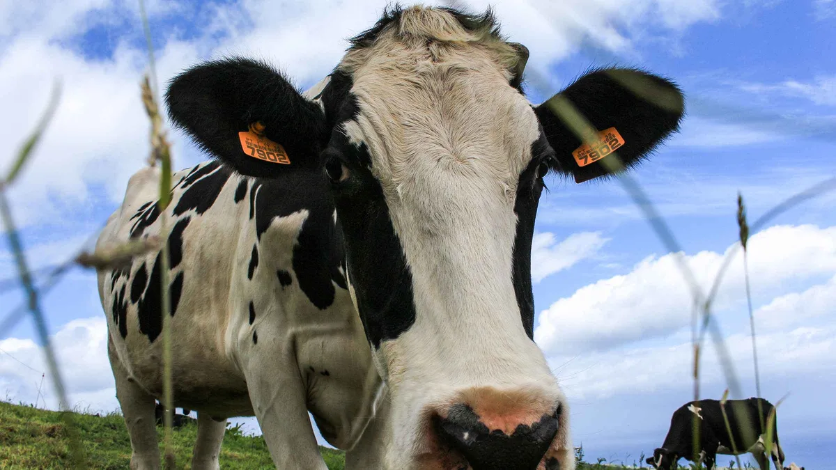
A one-day greatest-hits lap of Sao Miguel capped at 15: Vista do Rei, the Santa Iria viewpoint, a tea plantation, Furnas stew and more, with hotel pickup. Entrance fees at Furnas Lake and the stew meal are included. Good for short-stay travelers who want the island's highlights distilled into a single efficient day.
Check Availability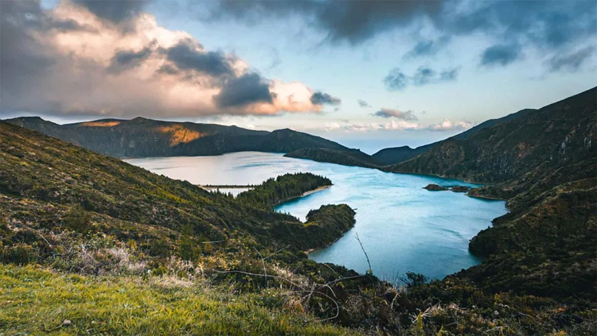 from $227.28
Private tour
from $227.28
Private tour Azores: Private tour to All São Miguel island with lunch
A private one-day sweep of the whole island by SUV with a certified guide, from the Sete Cidades and Fogo lakes to the Ribeira dos Caldeiroes waterfalls, Furnas and a lunch buffet, with skip-the-line access through a separate entrance. The itinerary and group size can be customized on request. Good for travelers who want everything in one day and are willing to pay for privacy.
Check AvailabilityPrices, ratings and details are the platform's own. dollar figures are the listed prices — the platform bills in your account's currency.
Zoom From the Map to the Plan
The Islands
All nine compared in prose, the map's companion read.
Getting to the Azores
The flight map behind the gateway pin, with the Stopover scheme.
Getting Around
How to move between the pins: buses, triangle boats and flights.
Azores Costs
The prices behind every pin that carries one.
Plan
Where the map fits in the wider trip planning hub.
What is so special about the Azores?
The documented list is long: two UNESCO World Heritage sites at Angra do Heroísmo and the Pico vineyard landscape, whale watching year-round in sanctuary waters, the highest point of Portugal at Mount Pico's 2350 m, and nine distinct islands. The islands overview compares all nine.
Can you fly direct from the US to the Azores?
Yes. SATA Air Açores and Azores Airlines list direct tickets from Boston and New York to Ponta Delgada, and from Toronto and Montreal. The Azores Stopover adds 1 to 7 days in the islands at no extra airfare on North America to Europe itineraries. Details in getting to the Azores.
What country do the Azores belong to?
Portugal. The islands use the euro, sit under the Portuguese flag at UNESCO, and run their own regional government. PDL airport at Ponta Delgada is the main gateway.
What is the best time to visit the Azores?
Ponta Delgada's climate normals show mean daily maxima from about 17 °C in winter to 26 °C in August, with December the wettest month and July the driest. The season you choose changes ferry lines, shuttle seasons and opening hours. See best time to visit.
Can you island hop by boat?
Only inside the ferry triangle. Atlânticoline's ten ports cover Faial, Pico, São Jorge, Terceira, Graciosa, Flores and Corvo, but no São Miguel port appears on the route list, so the green zone is unreachable by ferry. Read getting around.
How far apart are the islands?
No official source publishes inter-island distances, so this page will not invent them. The pins show the spread instead: Santa Maria nearest the east, Corvo and Flores farthest west, the triangle in the middle. Build a realistic sequence in plan.
The Azores Islands: Europe's Secret Volcanic Eden
Aerial documentary across the nine islands.
Video: VoyagersTVThe Azores: Europe's Hidden Paradise! (Travel Guide)
Island-by-island orientation before you zoom the map.
Video: Globe GallopersGeography of Azores in 1 Minute
The quick geographic primer that matches the table above.
Video: Pablo Correa PrietoWe may earn a commission if you book through one of our links, at no extra cost to you. Full affiliate disclosure